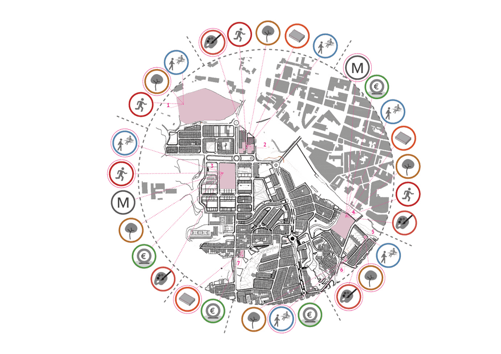
Joan Miró square


Joan Miró square

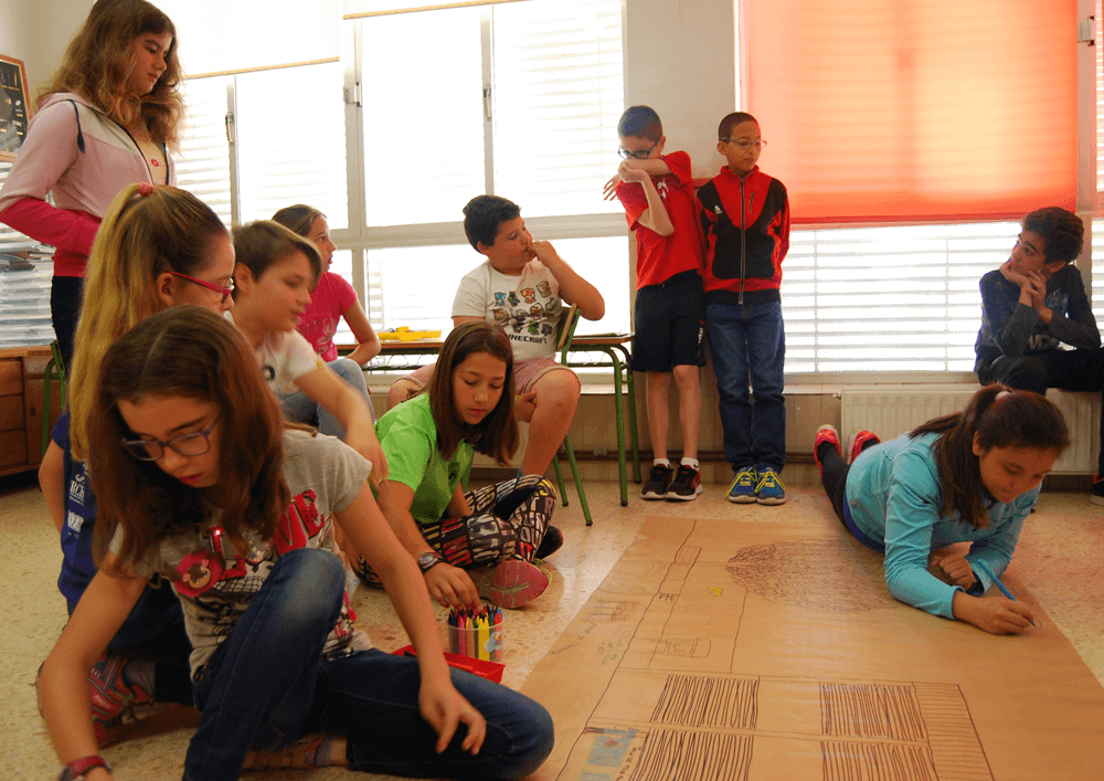
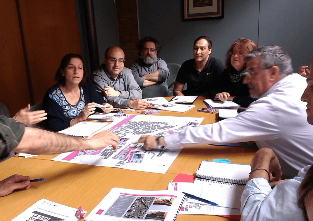
The criteria that lead to the definition of the square are the result of a close collaborative work carried out by the *estel team with the municipal personnel and politicians, the neighborhood residents and the entities, and the city’s associations. It is, in fact, the joint decision of all these agents, the engine of its renovation and transformation into an open stage.

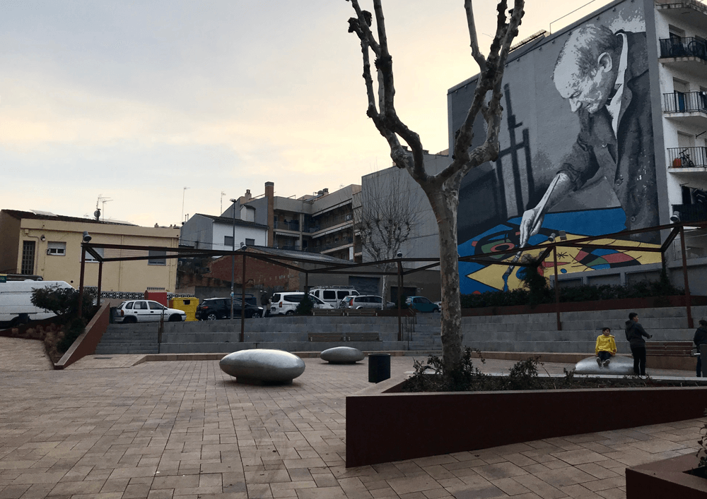
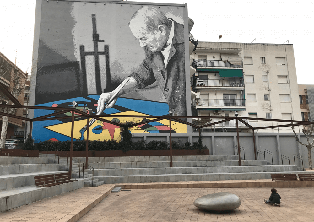
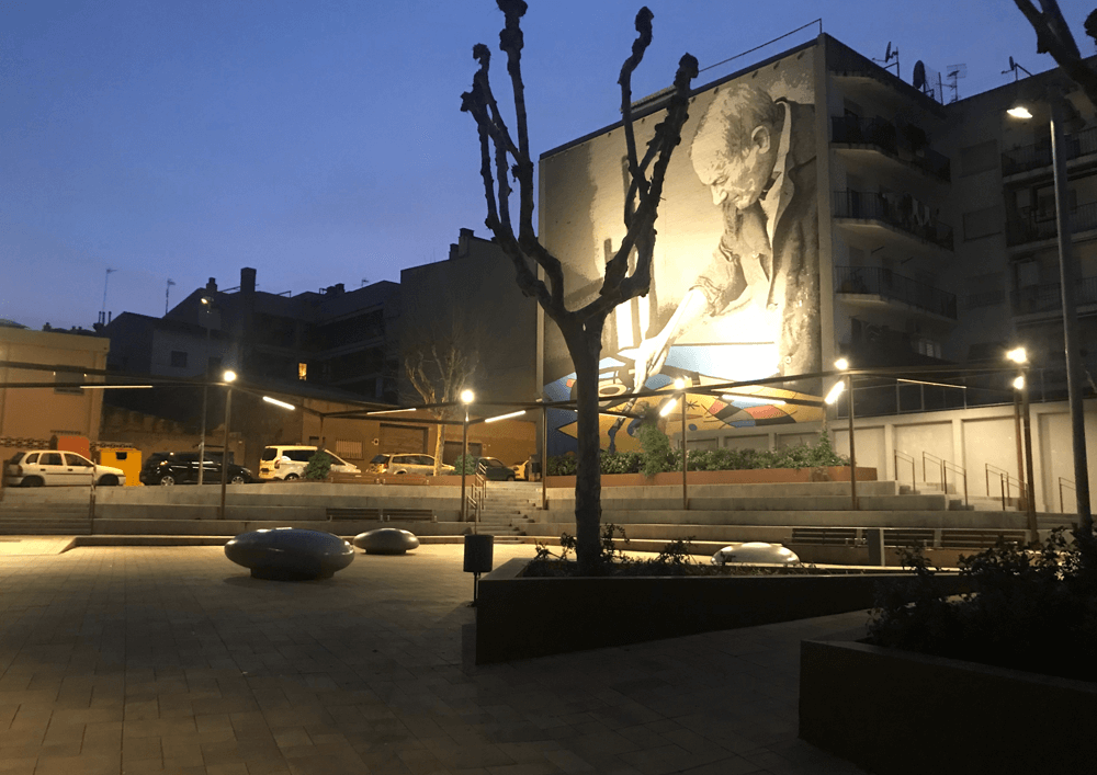
It is proposed the construction of some stands surrounding part of the square. This changes the directionality of the space, which can now be conceptually and materially extended to the adjacent section of Jacint Verdaguer street. The new layout varies the scene of the Dansa de la Batalla, an important Giants event held by the Festa Major, which is dignified by the renovation of the space, and organizes massive crowd increasing comfort and security of the event.

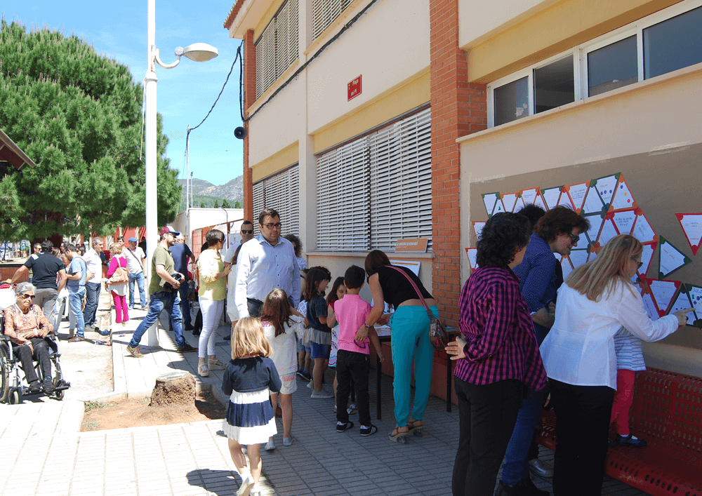
The challenge of hosting this annual event should not diminish the daily use by the neighbors of the square neither of the citizens nor the visitors of Montornès in general: it is, therefore, a public space that still works as an urban square. The proposal, however, modulates the intensity of its use as a play space to allow and enjoy a wider range of age groups. The new square reinforces its identity with a mural inspired by Joan Miró that renews the old one, with a reinterpretation designed, agreed, and carried out by the Venus local art association. The square thus reclaims the lost historical protagonism, consolidating itself as the end of the civic axis that will unite it with the square Pau Picasso.
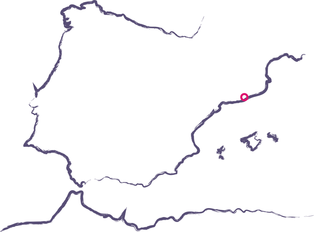
Place

Montornès del Vallès

[16,263 inhabitants]

Scale of the project

Public space

Type of project

Citizen cooperation

Public space design

Duration

12  months [2014-2015]

Promoter

Muicipality of Montornès

del Vallès


Team

*estel  (Arnau Boix,  Mireia Peris,

Marc Deu, Ara Muñío,

Esteve Boix, Claudia Villazón)


Itziar Gonzàlez, Elena Guim, 

Antoni Elvira, Carmela Torró


Collaborated

Neighbors of Montornès

del Vallès,

Colla de Gegants de

Montornès,

Art Venus Association,

Neighbors of the Plaça

Joan Miró,

Sant Sadurní School,

AAVV Montornès Centre,

Centre of the study of

Montornès del Vallès,

Unió de Botiguers,

Bar Chucu-chucu

Presentation

Check the good practices bank

Study

Read the full report at issuu

Read the full report at issuu

Press

Read more about the project at

Mostra d’Arquitectura Catalana,

somMontorès

The Pine’s plaza

The Pine's Plaza

The project for the reformation of the square (plaça) del Pi at Benifairo de la Valldigna incorporated since the beginning the inhabitants, especially children. The square holds an important part at the village’s entrance, creating a “bridge” between nursery and primary school and hosting el “Pi redó”, an emblematic tree which during the years turned into a meeting place -physical and symbolic- for every inhabitant. 

Initially, collaborative work took place including agents related to the project so to identify the main deficiencies of the space and define strategic lines for the future project. Once agreed, these ideas were specified progressively in order to create an urban design project. 

During the process, various participative techniques were used: from group interviews with the city’s technical-political team and with professionals linked to the school, to workshops with children, recording of memories regarding Pí redó and its surroundings, and open sessions in the public space with inhabitants. 

The proposal redefines the mobility circulation at the entrance and exit of the village, eliminates part of the parking space that is underused so that many square meters are freed up creating spaces of quality to pass time and play both for adults and children. 

Place

Benifairó de la Valldigna

[1,580 inhabitants]

Scale

Public space

Type of project

Urban strategies

Citizen cooperation

Public space design

Duration

Collaborative Diagnosis:

6 months [2017]


Urban design project:

3 months [2017]


Site management:

3 months [2018]

Promoter

Muicipality of Benifairó de

la Valldigna


Team

*estel  (Arnau Boix, Marc Deu,

Konstantina Chrysostomou)


Monodestudio, Urbanins,

Siete arquitectura más

ingeniería s.l.


Collaborated

Neighbors of  Benifairó de la

Valldigna,

Children and educational team

of James II el Just primary

school

Gender-based urban planning handbook

Gender-based urban planning handbook

Gender-Based Urban Planning Handbook is a tool to be used in order to put in the center, people’s daily life and promote an inclusive urban model that can incorporate gender diversity, age, or origin, in favor of building a safe and without barriers equitable city. 

The support tasks for the realization of the handbook had, as a result, an understandable and easy-to-use tool. The *estel team gave its support on writing, interpretation, and representation of data, and publication’s layout design.

Place

Barcelona

[1,620,343 inhabitants]

Scale of the project

Municipal

Public space

Type of project

Urban Strategies

Duration

10 months [2018-2019]

Promoter

Barcelona Regional


Team

Ana Paricio (Authorship)


*estel (Alba Domínguez i

Ferrer, Konstantina

Chrysostomou, Arnau

Boix i Pla)


Collaborators

Municipality of Barcelona

Handbook

View and download the

handbook

Premsa

Read more about the Handbook

at Municipality of Barcelona

Temporary activation of urban voids​


Temporary activation of urban voids

The crisis caused a slowdown in the usual way to “produce” the physical space of the cities, creating an area with voids waiting to develop (in the broadest sense of the word, not just referring to urban development). Given these circumstances, it became necessary to put into motion urban strategies and tactics so to activate the territorial resources available to the cities.

From this perspective, the Diputació de Barcelona proposed a framework of stable collaboration with the municipal entities in order to support them with strategies, tools, and proposals for the management of spaces that had remained empty in the municipalities of the province. Given the existence of these spaces in Santa Margarida de Montbui pending to build, urbanize or reconvert with new uses, and the reluctance on how to address this problem, the municipality asked the Diputación for its collaboration. And it is in this framework, the project was carried out by the team *estel

The project sought to identify the empty spaces in the municipality to avoid degradation and to propose new temporary uses able to cover local social needs. Specifically, those activities were requested in the past by the population but did not have a municipal response either to municipal facilities or existing public spaces.

A collaborative diagnosis was made on the plots identified both from citizens and the council’s technical-administrative team. Some of these plots, near the river Anoia, have an industrial value present in the built heritage. Others, near the neighborhood of Pi, follow the history of the tanneries of the area and a marked tradition of self-organization. From this diagnosis, a process of revitalization of the urban space was proposed through the synergies that were discovered in the territory, consisting of the creation of protocols of activation of the empty spaces.

Place

Santa Margarida de Montbui

[9825 inhabitants]

Scale of the project

Municipal

Type of project

Urban Strategies

Citizen cooperation

Duration

8 months [2015-2016]

Promoter

Barcelona Provincial Council

Municipality of Santa

Margarida de Montbui


Team

*estel  (Arnau Boix, Mireia Peris,

Raimon Soler, Laia Llonch)

Presentation

Check the presentation at Prezi

Study

Read the full report at Issuu