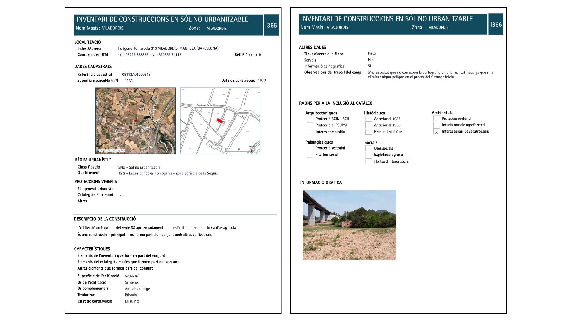
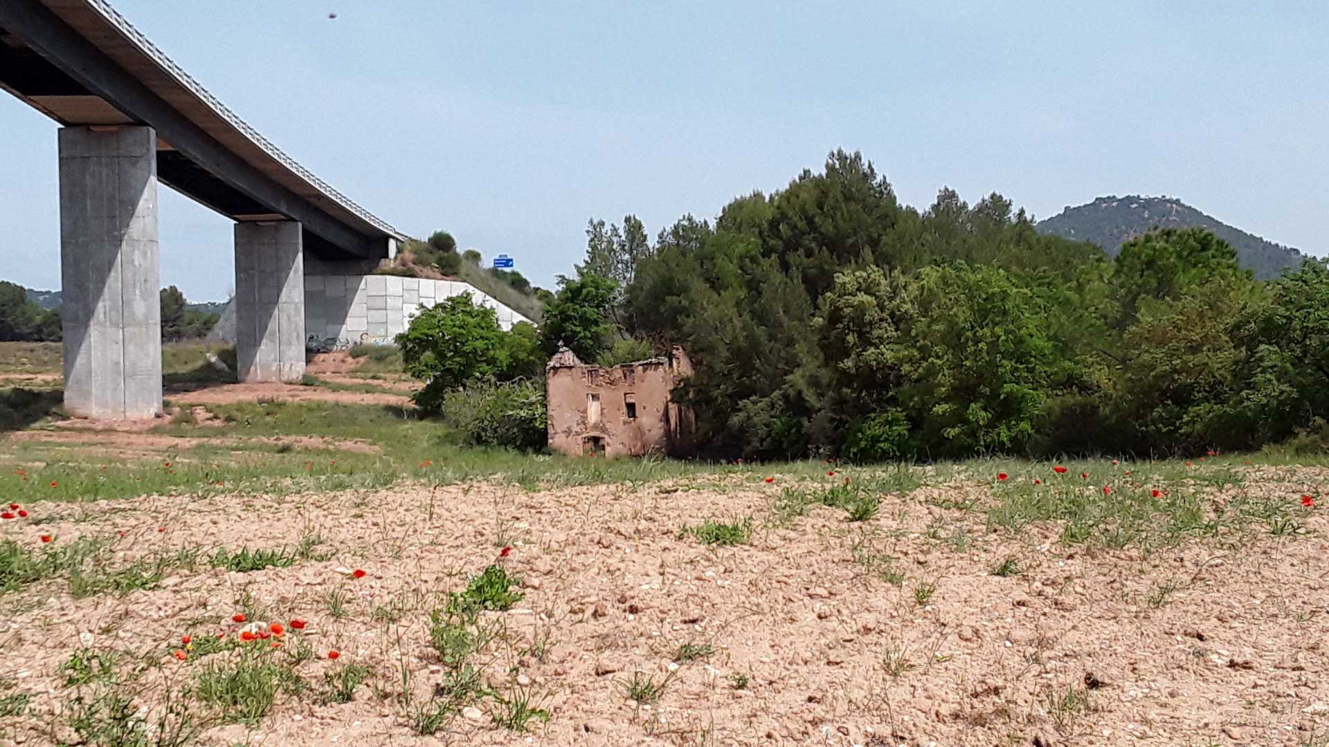
Inventory of constructions on undeveloped land
The regulation of the undeveloped land is one of the challenges that municipalities will face in the coming years, as a balance must be found between the uses and activities that are allowed and the preservation of the natural habitats and ecosystems of each territory.
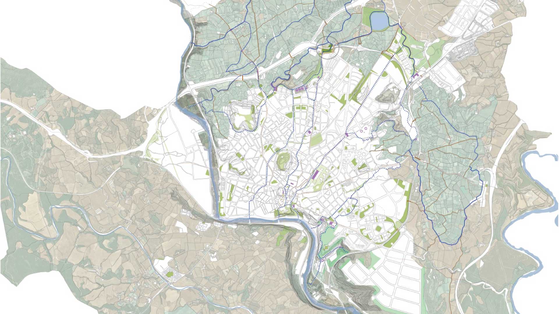
In this context, the city of Manresa has promoted the creation of an inventory of buildings in undeveloped land in order to know the current reality of the municipality before deciding how to transform it, in parallel to the catalog of Masias already definitively approved.
Our approach to the project as *estel was to understand the architectural, urban, and environmental characteristics of each element included in the study, but without forgetting the social and human components that these constructions have. In an environment such as Manresa, they play a key role in structuring and articulating the territory, and in defining the character and identity of the people who inhabit it.
The collaboration with Solucions Geogràfiques team has allowed us to integrate GIS technology in a transversal way throughout the work, and facilitate the management and updating of information in the future.
Place
Manresa
[76,250 inhabitants]
Scale
Municipal
Type of project
Urban Strategies
Duration
11 months [2019]
Promoter
Municipality of Manresa
Team
*estel (Marc Deu, Alba
Dominguez, Arnau Boix,
Konstantina Chrysostomou)
Solucions Geogràfiques