Executive Participated Project for the Plaça del Sol


Executive Participated Project for the Plaça del Sol

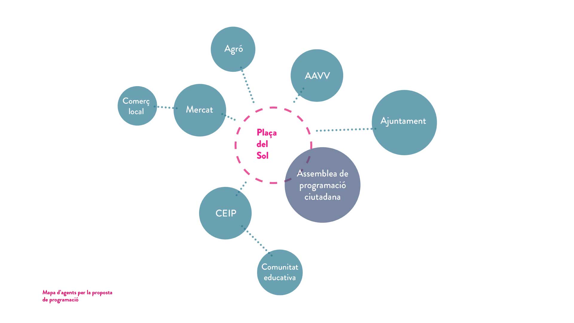
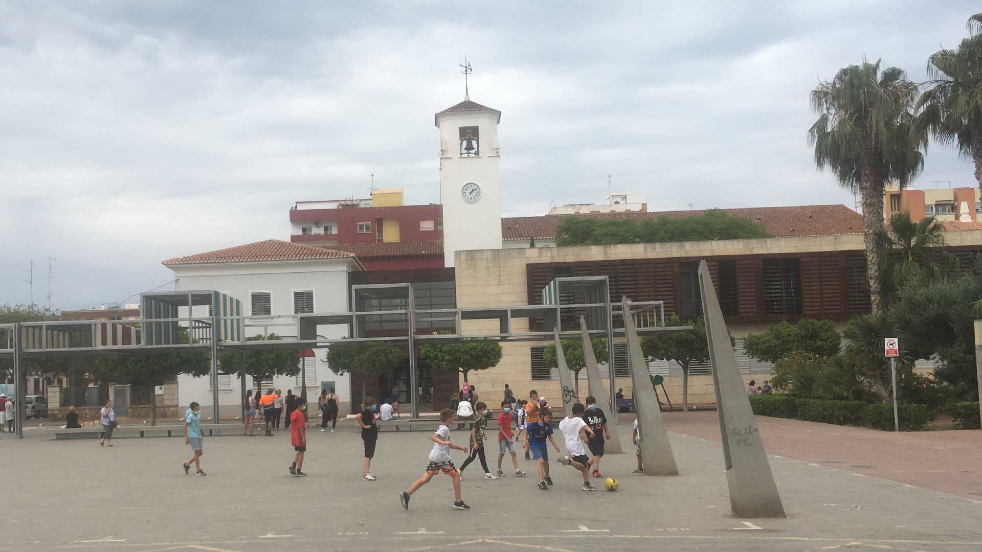
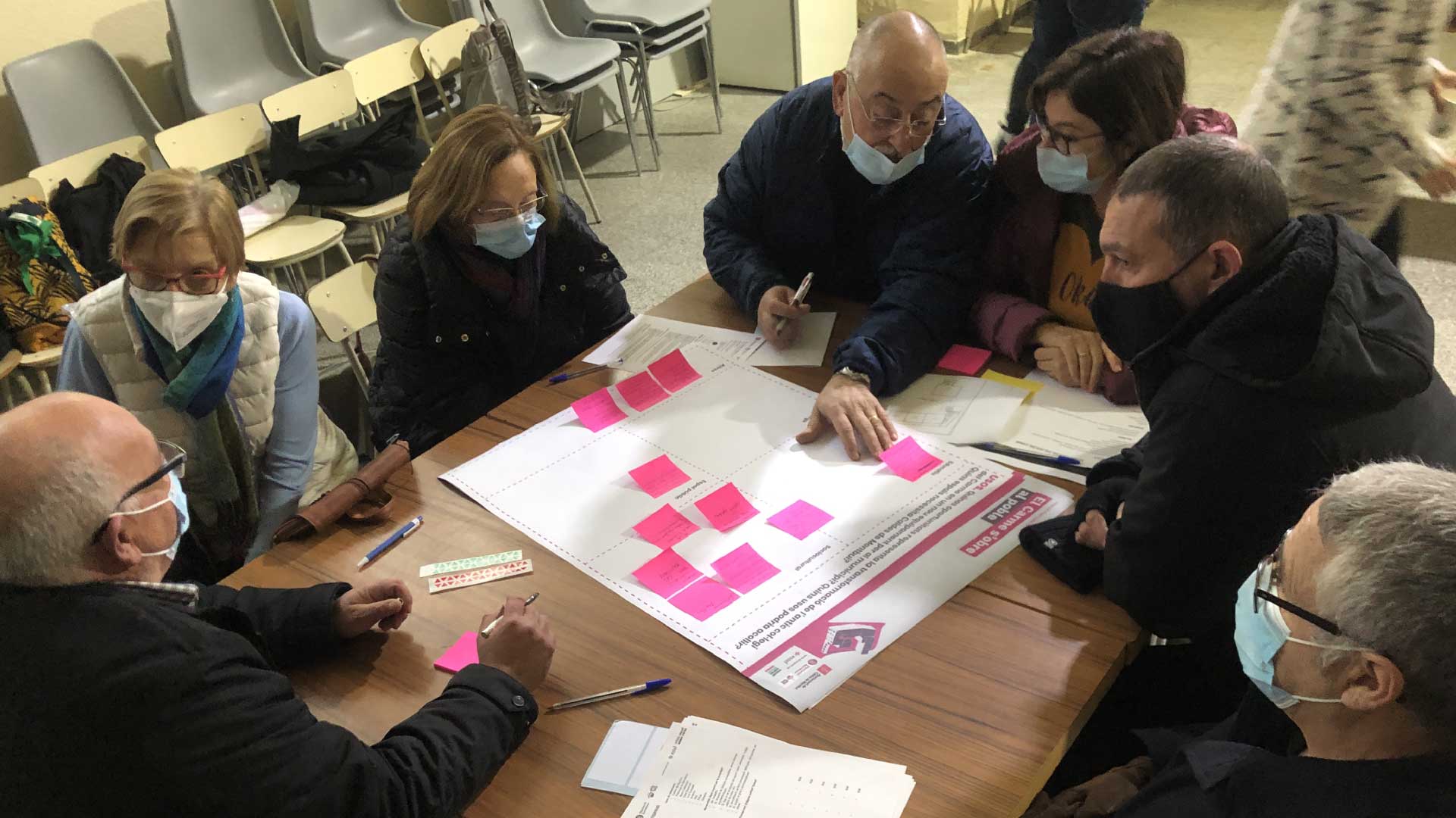
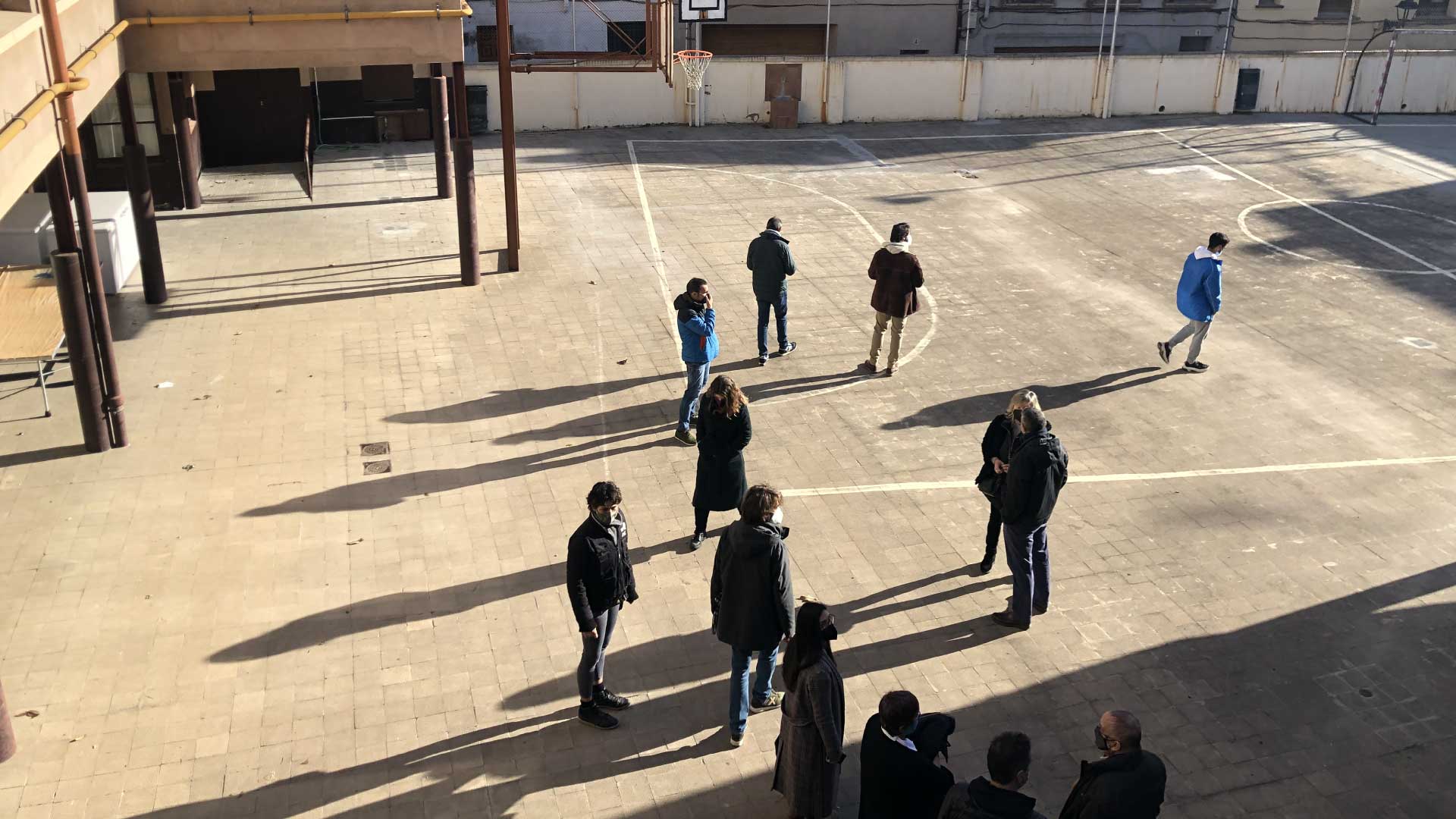
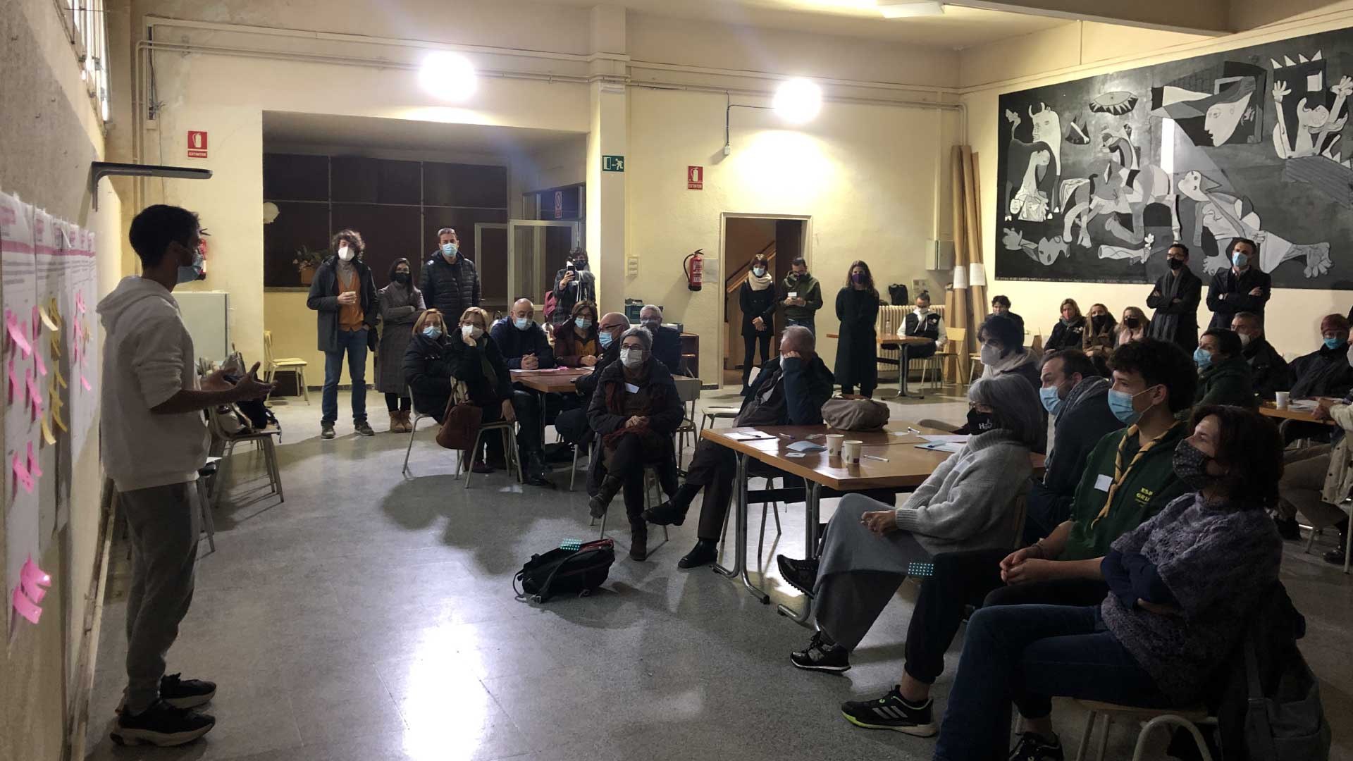
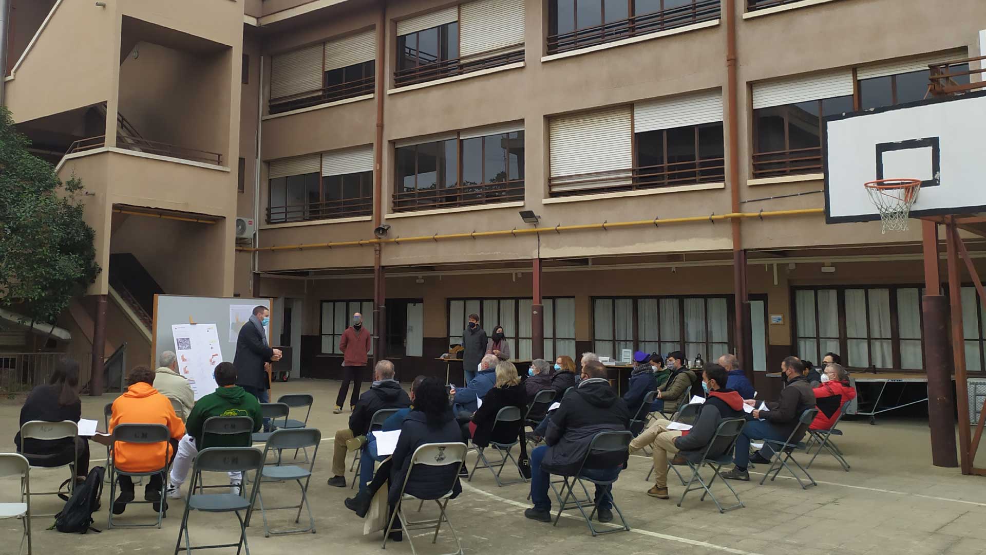
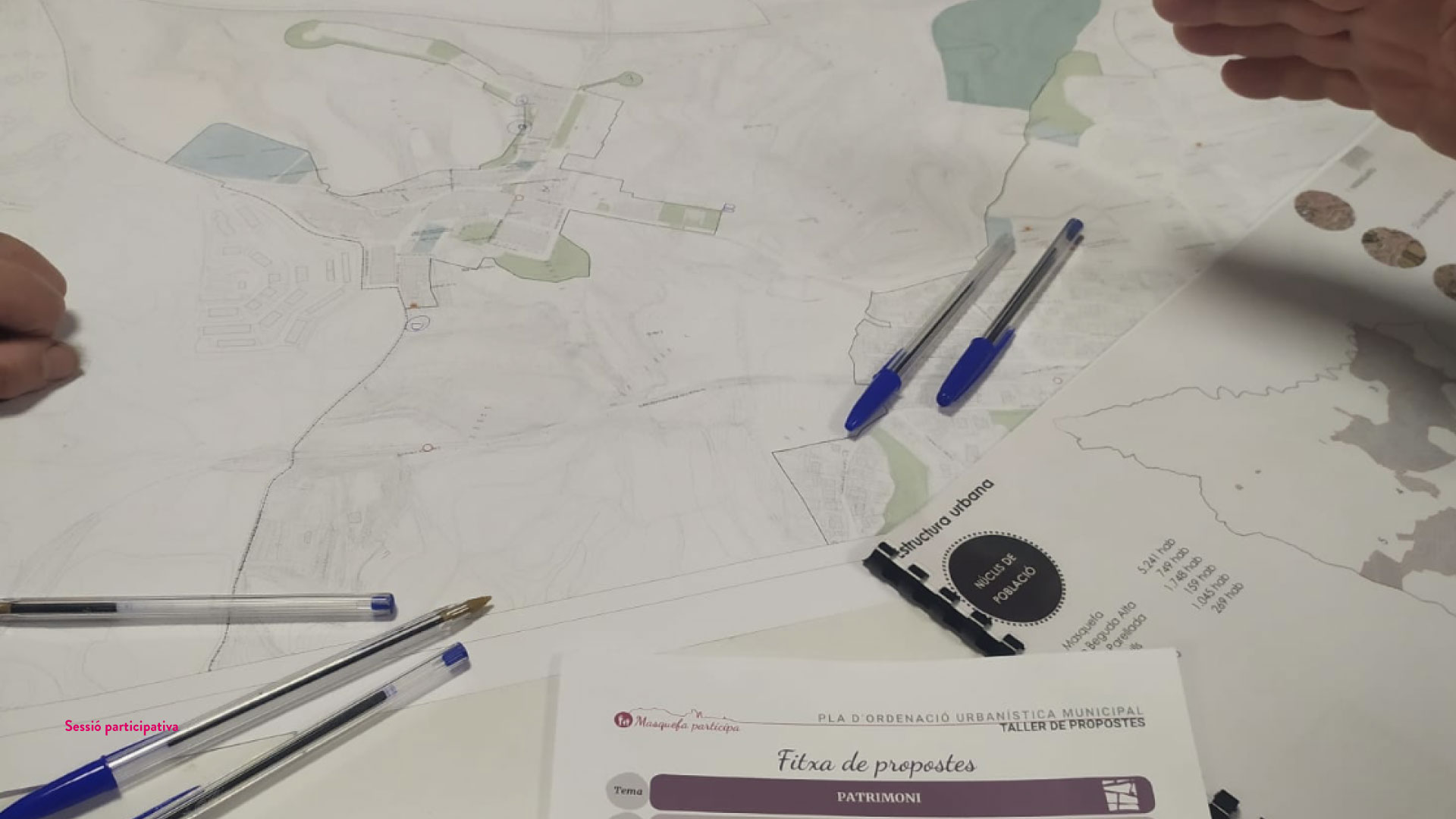
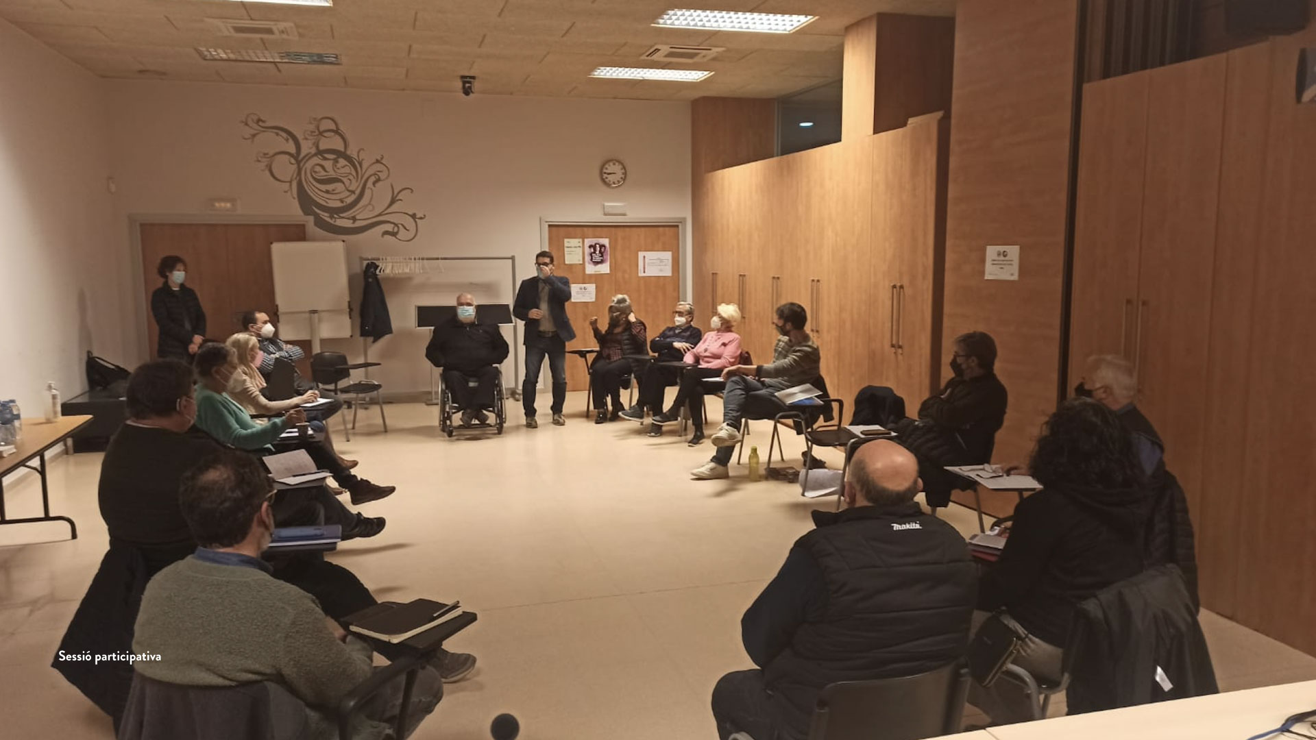
The drafting of a Participatory Executive Project to redevelop the Plaza del Sol in Puerto de Sagunto was based on a collaborative work methodology between the municipal technicians and technicians, the drafting team, and the neighborhood and the municipality’s social and economic agents.

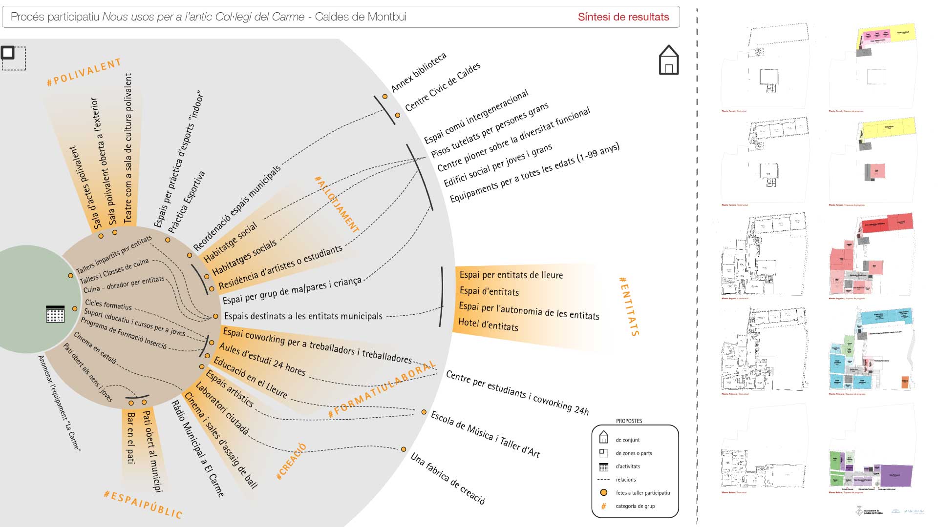
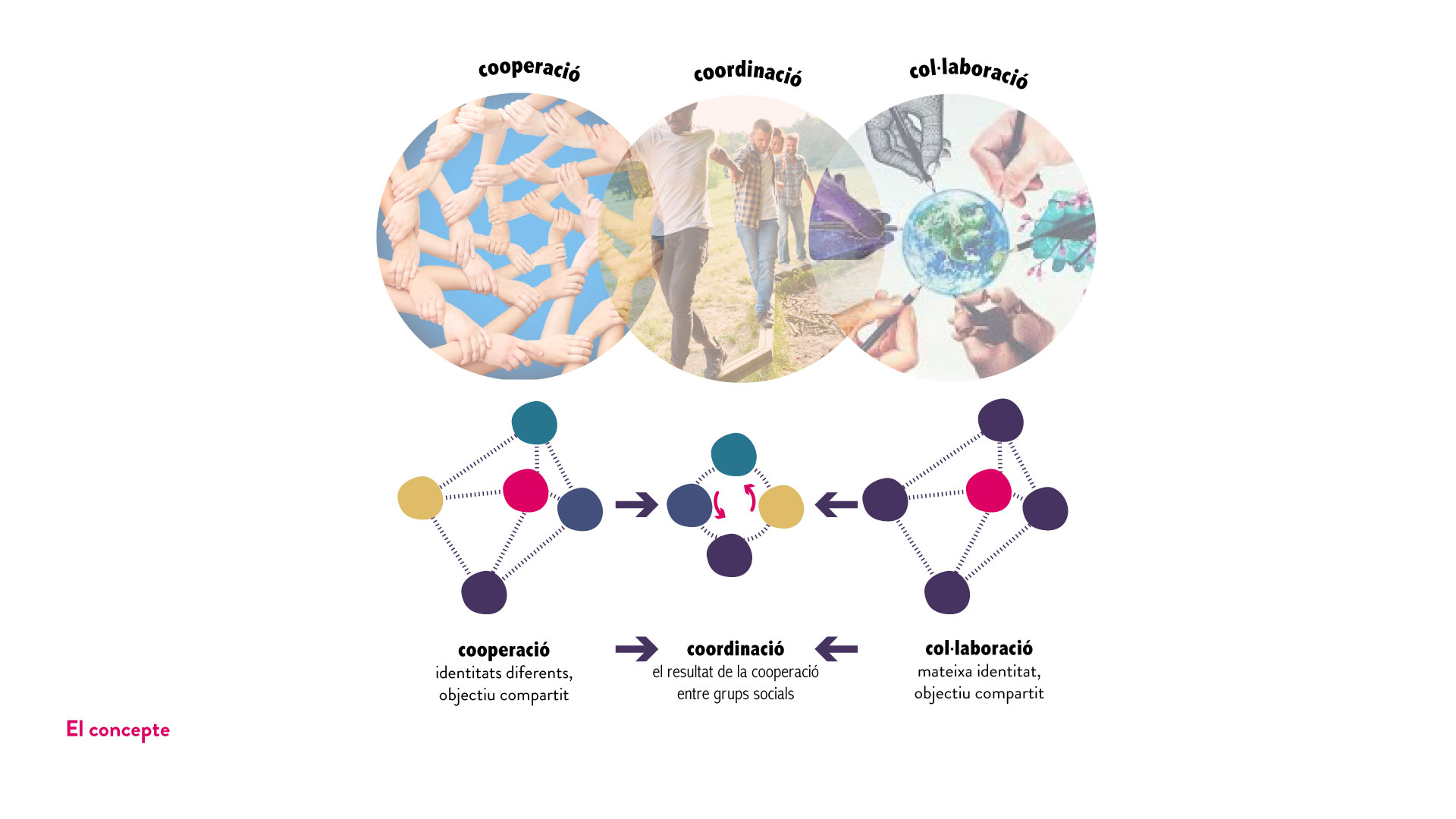
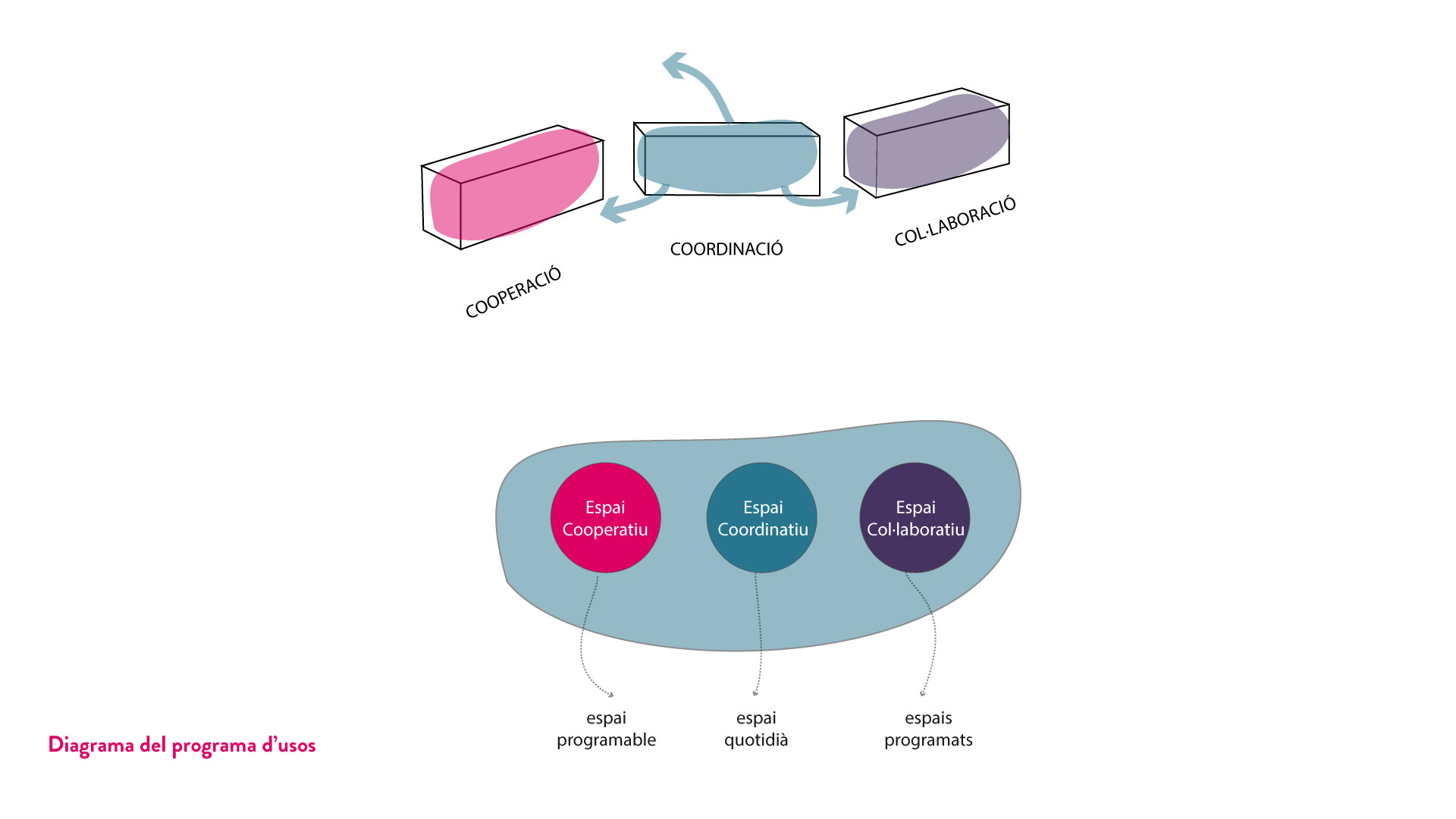
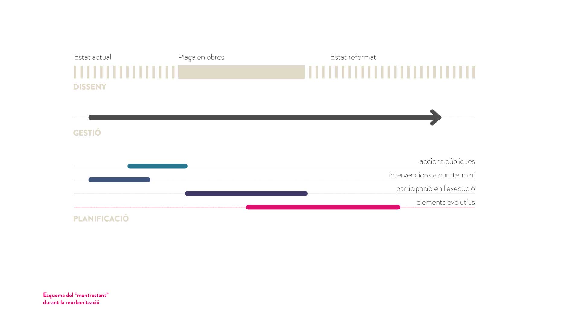
The resulting document incorporates, on the one hand, the political-technical and citizen perspective and the recognition of their contributions; on the other, management strategies, dynamization, or change planning. These strategies are proposals for interventions (short, medium, or long term) that do not necessarily involve works and that accompany the transformation process of the square but, above all, in the “meanwhile,” that transformation does not take effect.

This collaborative work, beyond the formal result of the new Plaza del Sol, has settled the decisions taken on, among others, the following agreements:

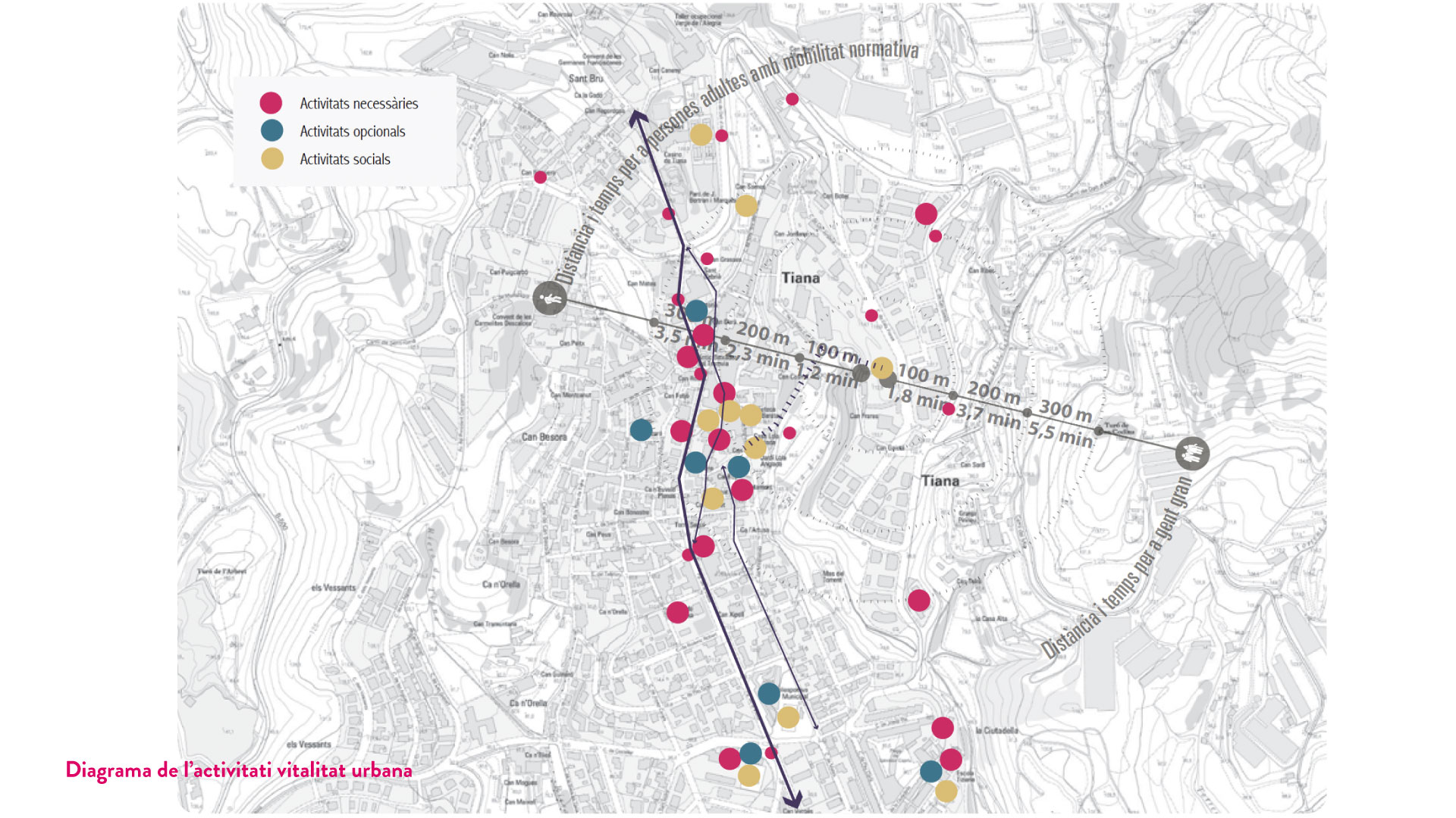
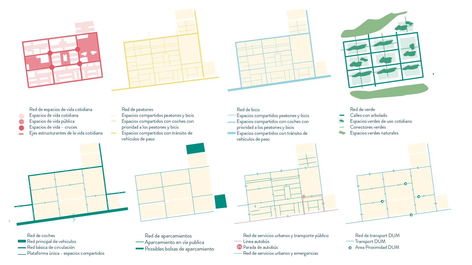
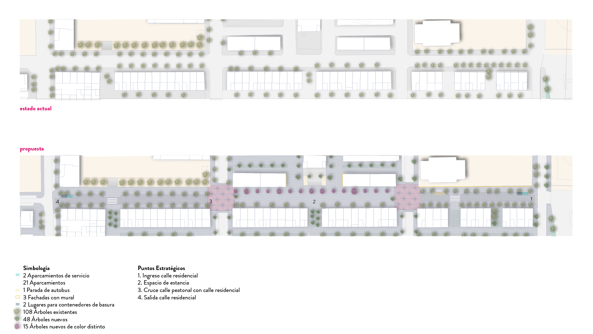
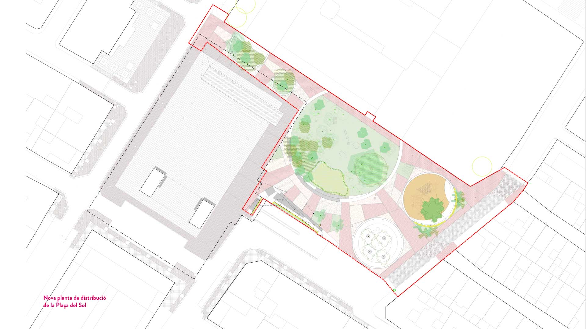
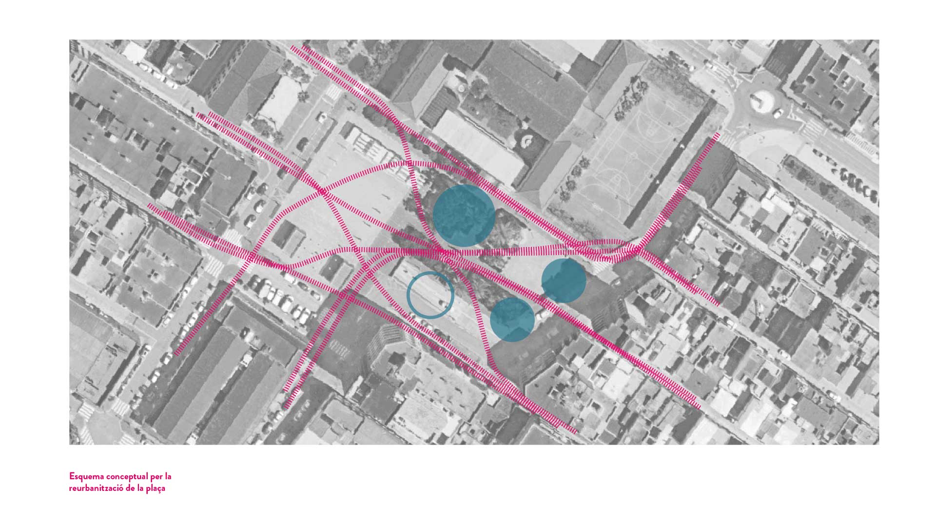
Design criteria: respect and reinforce the itineraries of passage and connection between neighborhoods and recognize the square as a crossing point. Promote living and permanency spaces, have urban elements that facilitate this and identify the square as a meeting place. Incorporate and apply the concept of climate shelter in the square and reuse or rehabilitate existing urban and material elements as much as possible.

Management criteria: promotion of co-responsibility with the maintenance of the square by involving the CEIP Nuestra Señora de Begoña so that the students promote dissemination actions on the importance of cleaning the public space or that include didactic units in the school curriculum related to the care of urban nature. Promote artistic interventions in the public space that reinforce the Plaza del Sol’s identity and facilitate the neighborhood residents’ feeling of belonging. Enable the permanent availability of public toilet services in the Municipal Market building.

Planning criteria: carry out public communicative actions related to the transformation process of the square, its calendar, and the final result after the works. Incorporate evolutionary or progressive shading elements to condition the plaza climatically while the new vegetation needs to acquire a sufficient size. A general performative activity of identity transition could also be carried out: a ceremony of removal and change of location of the statue of the worker, and putting into value the new character of the sun and the shadow.
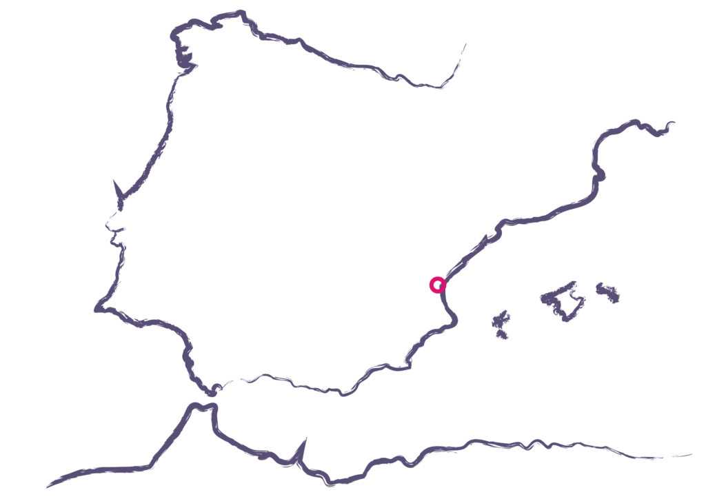
Place

Sagunt

[67.043 inhabitants]

Scale

Neighborhood

Type of project

Urban Strategies

Citizen cooperation

Public space design

Duration

6 months [2021]

Promoter

Ajuntament de Sagunt


Team

*estel (Arnau Boix,

Konstantina Chrysostomou,

Marc Deu, Alba Dominguez)

SUC arquitectes

Maria Pedro

Ivana Ponsoda

AIG (arquitectura ingeniería y

gestión)


Collaborators

Sagunto City Council

technical team,

Neighbors and municipal

entities

Press

Read more at El Periòdic

New uses for the former Col·legi del Carme


New uses for the former Col·legi del Carme

Incorporating the old Col·legi del Carme into the municipal resources and equipment is one of these draft projects that need to contrast the starting assumptions of the Caldes City Council with the vision of the people who will use it, the final recipients of the space. And it is particularly because of the symbolic charge and the deep roots in the collective memory that this building has.

The work process we propose, in close collaboration with Equal Saree, aims to make visible this collective memory of the future tools, making it possible for citizen participation to give it use and function. But above all, it is an active part of its creation, promotion, and management, so it is guaranteed that the proposals launched for this new use make sense for the municipality and offer a space to recognize each other.

The participatory sessions are focused on the will to open spaces of cooperation between the political-technical team of the City Council, the group of drafting architects (Mangrana architects) of the preliminary draft of the new proposal for the old Col·legi del Carme, and the associated citizens and not associated with Caldes de Montbui. Through restricted technical sessions and workshops open to the public held in the equipment area, a process of cooperative work takes place in which the architectural decisions advance at the same time as the joint report on technical requirements, community needs, and citizen wills.

The participatory process “El Carmen s’obre al poble” developed progressively and cumulatively from face-to-face meetings and digital support tools, including the municipal platform “Decidim” and an electronic suggestion box. It was about, based on the recognition of historical use and the memories and experiences accumulated in the old school, contrasting the current technical and citizen needs of the municipality and trying to distribute them among the different spatial resources offered by the equipment.

Thus, the program of needs enjoyed broad agreement among all the participants, assuming, among others, the opening of the large patio of the equipment as a new public space of the municipality, underlining the importance of the flexibility of the spaces and the maintenance of the social and historical essence of the whole building.

In addition, the Follow-up Commission established during the participatory process assumed the proposal of citizen involvement throughout the planning, transformation, and commissioning process. The method of transforming the equipment will necessarily take time, and we did not want to miss the opportunity to carry out activities in the “meanwhile,” to give continuity to the reflections on co-management initiated in the process and to advance the feeling of belonging and citizen reappropriation of the future equipment.

Place

Caldes de Montbui

[17.797 inhabitants]

Scale

Municipal

Tipus de projecte

Cooperació ciutadana

Duration

3 months [2022]

Promoter

Municipality of Caldes de Montbui


Team

*estel (Arnau Boix i Pla,

Konstantina Chrysostomou,

Marc Deu Ferrer, Alba

Domínguez Ferrer)

Equal Saree


Collaborators

Political and technical team of

the City Council

Mangrana architects

Neighbors of Caldes de Montbui

Municipal entities

Presentation

Presentation video of the

participatory process

Press

News about the process on local

television

Participatory process for the land use masterplan of Masquefa


Participatory process for the land use masterplan of Masquefa

The citizen participation process of the land use masterplan (POUM) of Masquefa is developed in parallel with the drafting of the urban planning document (in charge of OUA) with the intention of turning the drafting of a Municipal Urban Planning Plan into an opportunity for the different sectors that make up the society to collaborate with each other, and jointly define what is the municipality they want for the next few years, dealing with topics ranging from housing, economic activity, public space and equipment, natural spaces or the infrastructures that make up the territory.

In this participatory process, apart from combining face-to-face and virtual spaces to facilitate access to the debate, an effort has been made to recognize the territorial complexity of the municipality, where there is a consolidated urban center where the majority of services are located, with a series of low-density urbanization with fairly marked own dynamics. The objective, then, is that the project serves to collect the proposals of all these people involved, at the same time that the process itself helps to increase territorial cohesion and the links between neighborhoods.

Place

Masquefa

[9.623 inhabitants]

Scale

Municipal

Type of project

Citizen cooperation

Duration

6 months [2021 – 2022]

Promoter

Municipality of Masquefa


Team

*estel (Alba Domínguez

Ferrer, Marc Deu Ferrer,

Konstantina Chrysostomou,

Arnau Boix i Pla)


Collaborators

Neighbors of Masquefa

Urban and Sustainable Mobility Plan of Barx


Urban and Sustainable Mobility Plan of Barx

Barx, like the rest of the neighboring towns and cities, has experienced in recent decades an evolutionary process of its mobility based on unsustainable parameters over time.

Often the high presence of private vehicles means that many of the other activities that take place in the street are relegated to the background, either because of the difficulty or danger of developing them simultaneously, or directly because of the lack of space.

It is in this context that this study is being developed, which aims to reverse these dynamics and establish a viable action plan adjusted to the needs that will make it possible and improve the quality of public space. To do this, a complete diagnosis of the current reality has been carried out, which contemplates both the analysis of the capacities and the intensities of use of the road network with different modes of transport, as well as the coexistence of these journeys with the other activities that take place on public roads, linked to the development of the daily life of its inhabitants.

Place

Barx

[1.229 inhabitants]

Scale

Municipal

Type of project

Urban Strategies

Duration

8 months [2021]

Promoter

Municipality of Barx


Team

*estel (Marc Deu i Arnau Boix,

Alba Domínguez Ferrer,

Konstantina Chrysostomou)

Pau Avellaneda


Collaborators

Vecindario de Barx

Cals Frares, NGOs’ House

Cals Frares, NGOs’ House

Tiana City Council promoted the participatory process for transforming the newly constructed buildings into new association equipment, co-designed with the municipal entities and the technical and political team. Over the last few months, we’ve worked on the proposal with Tiana’s associations and the municipality’s technical and political group. 

The “Cals Frares, NGOs’ House” is a municipal facility for the use of associations and non-profit organizations in Tiana, offering a model for creating a civic ecosystem. This equipment facilitates:

  • associative work, offering various spaces for its development,
  • collaboration in the growth and improvement of the associative movement
  • the possibility of an inter-associative relationship between the different entities.

The “Cals Frares, NGOs’ House” provides workspaces and opportunities for associations and groups to participate in socio-cultural activities, learn, explore and create. This site hosts various cultural, artistic, and educational programs and activities to foster creativity and community trust. It facilitates situations for people to get together and get to know each other.

The foundation and operation of the “Cals Frares, NGOs’ House” is based on a cooperative approach, from its creation to its function. This site serves as a tool for this cooperation model, as the members of the NGOs and groups are the most active part of society, bringing together people of all ages, professions, and nationalities. The association’s role in developing civil society is growing along with the municipality’s support for joint projects and activities.

With the transformation of the “Cals Frares, NGOs’ House” into a generator of social life for the municipality of Tiana, it is possible to achieve:

  • Strengthen local identity.
  • Generate an intergenerational social and cultural meeting point for the population that does not exclude anyone.
  • Democratize access to municipal resources and improve the quality of life for all.
  • Encourage community involvement and allow the community to act in their municipality through the House of Entities their resources to start new activities and services.
  • Create a third place that plays a significant role in the public life of the municipality.
  • Promote collaborations and exchange of knowledge between entities and groups.

Based on an analysis elaborated on the territorial, administrative and social context in which the new building is located and through a participatory process with the technical and political team and the entities, associations, and groups of the municipality, we were able to define the following:

  • the site identity,
  • the program of the use,
  • the distribution proposal,
  • the architectural intervention criteria,
  • the criteria for the incorporation of the gender perspective,
  • the management proposal and, 
  • the “meanwhile” activities.

Placd

Tiana

[9,009 inhabitants]

Scale

Municipal

Type of project

Urban Strategies

Citizen cooperation

Duration

5 months[2022]

Promoter

Municipality of Tiana


Team

*estel (Konstantina

Chrysostomou,Roser Garcia

Piqué, Arnau Boix i Pla, Alba

Domínguez Ferrer, Marc Deu i

Ferrer)


Collaborators

Associations of Tiana

Presentation

Check the presentation at  prezi

Participatory process to expand the inventory of the cultural heritage of Terrassa

Participatory process to expand the inventory of the cultural heritage of Terrassa

The Participatory Process associated with the Advance of the specific Modification of the POUM to expand the inventory of assets of Cultural Heritage of Terrassa, has been carried out between September 2021 and January 2022. Highlight the city’s heritage of the city, and elaborate on a proposal of regulation that has the citizen’s knowledge that has opened this space of participation in an initial phase of the urban processing.

Terrassa is a city with remarkable heritage value. Noteworthy examples include: (1) the monumental ensemble of the Cathedral of Ègara which was founded in the middle of the 5th century with the Romanesque churches of Sant Pere and Santa Maria, (2) the Gothic altarpieces of the 15th century, (3) the Carthusian Castle of Vallparadís which is originally from the 12th century and was converted into a Carthusian monastery in the 14th and 15th centuries, and (4) the cloister of the Convent of Sant Francesc from the 17th century.

With the Catalan industrial revolution, Terrassa became a major center of the textile sector in the late nineteenth and early twentieth centuries. Factories, warehouses, and residential buildings are concentrated in the city during the period of Modernism, with such remarkable examples as Masia Freixa and Casa Alegre de Sagrera.

For the citizens of Terrassa, the patrimonial elements become elements of identity. It is an active citizenry concerned with conserving and preserving these assets that are relics of the familiar past and translate into citizen pride. The link is based on associations of residents interested in heritage, which have the support and advice of entities such as the Heritage Board and the Center for Historical Studies of Terrassa. Terrassa City Council gives them a voice to express their opinions and assessments in expanding the inventory of Terrassa’s Cultural Heritage assets. In short, a review and group reflection to continue guarding the heritage with the best possible conditions in a correlative legacy from past to future.

The objectives from which the participatory process is set are:

  • Facilitate the dissemination and understanding of the progress document of the MPOUM, and the background linked to the regulation of the Cultural Heritage of Terrassa.
  • Achieve a higher quality plan/project: Collect different perspectives and proposals on the elements to be regulated and the criteria to be considered.
  • Weave new relationships and improve governance with the affected agents of the territory, to facilitate their management and monitoring during the participatory process and the following stages of urban planning.

Place

Terrassa 

[218,535 inhabitants]

Scale

Municipal

Type of project

Urban Strategies

Citizen cooperation

Duration

8 months [2021-2022]

Promoter

Municipality of Terrassa


Team

*estel (Marc Deu i Ferrer,

Konstantina Chrysostomou,

Arnau Boix i Pla, Alba

Dominguez Ferrer),

Fàtima López Pérez,

Pablo Tardio


Collaborators

Neighbors of Terrassa

Press

Read more about the project

at the participa.terrassa

Participatory process for the Master Plan of the Vapor Albinyana’s suroundings


Participatory process for the Master Plan of the Vapor Albinyana’s suroundings

The participatory process of this project is part of the drafting of the document “Master Plan of the Vapor Albinyana’s surroundings: Diagnosis and development strategies.” 

The document serves to make a careful diagnosis of the problems within the area as a preliminary step to raise a set of proposals to be used in public and private areas, which dynamizes and prevents the loss of heritage values.

The objectives of the participatory process are:

  • Disseminate technical work concerning the Master Plan
  • Facilitate the collection of citizen contributions to complement the technical work carried out in recent months and promote collective reflection by incorporating the neighborhood’s vision.
  • Facilitate the follow-up of the process of this strategic document once the participatory process is completed

The team (Jordi Peralta Fernández + *estel)  proposes a holistic and experiential study approach. Create territorial reading at all scales by observing everyday life and the interrelationships it establishes in the neighborhood’s ecosystem. The methodology of the process intrinsically includes all the lines of work involved in the 2030 Agenda in its social, physical, environmental, and economic dimensions and its objectives to enrich this technical vision with citizen perception and aspiration. The work process organizes different participatory formats that are transdisciplinary and transparent.

This process aims to combine the awakening of the environment’s capabilities to respond to the needs detected with the perspectives and knowledge of technicians and citizens. Through their respective direct or indirect involvement in the work process, people of any age, condition, and situation have participated in the process.

The team put activities together to gain a greater understanding of the context. These organized activities included in-situ observations, preliminary conversations with crucial actors in the territory, a survey, two participatory sessions, and a return session to the citizens, the technical, and the political team of the Municipality of Terrassa and the Diputació de Barcelona.

Place

Terrassa

[218,535 inhabitants]

Scale

District

Type of project

Urban Strategies

Citizen cooperation

Duration

11 months [2021-2022]

Promoter

Diputació de Barcelona

Municipality of Terrassa


Team

Jordi Peralta Fernández

*estel (Konstantina

Chrysostomou, Arnau Boix i

Pla, Marc Deu i Ferrer,

Alba Dominguez Ferrer)


Collaborators

Neighbors of Terrassa

Associations of Terrassa

Press

Read more about the project

at the platform

participa.terrassa and at the

press

Socio-territorial analysis in the Study of Urban Landscape of the Tres Turons


Socio-territorial analysis in the Study of Urban Landscape of the Tres Turons

The Tres Turons area is a unique area between the city and the Sierra de Collserola Natural Park where highly impressive environmental and landscape conditions give attention to a profound review of the structure and quality of the urban landscape.

In this complex space, the Urban Landscape of the districts of Horta Guinardó, Gràcia, and Eixample, paired with a high variable of social, cultural, leisure, and economic dynamics, has evolved according to very different patterns and conditioning factors. Buildings and urbanized spaces are structured around the Turons with sizes and densities that condition the quality of the urban landscape, inevitably marked by the topographical relief. Topography, in fact, is the structuring system of the area that conditions environmental and landscape variables at the same time.

The study is divided into 5 large chapters (Study of historical evolution, Eco-environmental diagnosis, Relevant aspects of the urban landscape, Social structure and services, Human Landscape: everyday life). These chapters are linked to each other, emphasizing the multiple interactions between ecology and landscape. Human, economic and social dynamics converge coherently in a comprehensive transformation strategy to improve the quality of the Tres Turons landscape as a whole.

In this case, *estel was part of a very large team of professionals and focused on the socio-territorial study, intending to analyze the human landscape and the daily dynamics of the neighborhoods. The goal of the project was to understand how people relate to the territory as well as to each other.

In order to understand this complexity of administrative and social structuring in a territorial area of ​​these dimensions (7 neighbourhoods), a cycle of debates has been carried out with representative agents of the neighbourhood. These debates have been complemented with various observation sessions of the public space. As a result, it was possible to report information regarding the identity of the Three Turons. The project was able to ask questions such as: what is the identity of the field, what is the approach to the perceptual field as it relates to the unions and perceptive borders, what are the structuring elements and generators of daily life, and what is the perception of comfort, autonomy and safety in public space.

Place

Barcelona

[1,620,343 inhabitants]

Scale

District

Type of project

Urban Strategies

Citizen cooperation

Duration

6 months [2021-2022]

Promoter

Municipality of Barcelona;

Institut del Paisatge Urbà

(Urban Landscape Institute)


Team

B2B Arquitectes (Jordi

Bellmunt, Agata Buscemi)

Irbis,

*estel (Konstantina

Chrysostomou, Marc Deu,

Arnau Boix i Pla, Alba

Dominguez Ferrer),

Fàtima López, Montserrat

Mercadé, Veclus S.L.


Collaborators

Technicians of the

neighborhoods:

Vallcarca i els Penitents, la

Salut, la Teixonera, La Font

d’en Fargues, el Guinardó, Can

Baró, el Coll, el Carmel

Neighborhood associations

and groups:

Vallcarca i els Penitents, la

Salut, la Teixonera, La Font

d’en Fargues, el Guinardó, Can

Baró, el Coll, el Carmel

Participatory budgets of the Valencian Community


Participatory budgets of the Valencian Community

The Autonomous Participatory Budgets are a pilot project of the Generalitat Valenciana that was launched in 2021. It aims to develop a participatory process to decide the actions to which a part of the Generalitat’s budget will be dedicated. It is a powerful tool to move towards an open government that revolves around citizen participation. It opens this process to 5 million Valencian men and women, counting on all the territories and investing in those who need it most.

Participatory Budgets aim to empower citizens and provide public information, transparency, equality, inclusion, gender perspective, territorial solidarity, and accountability. They are also based on the 17 Sustainable Development Goals.

In this project, Monodestudio was the coordinating team, and *estel was the driving team of the Hackatons; These conferences combine information on the process, training on the theme of each action, and the facilitation of a guide space for the design of proposals for the budget, linked to the proposed territorial scale of the counties. Also, we create communicative content to explain the process and the results of the participatory budgets to the citizens.

Place

Valencian Community

[5,057,353 inhabitants]

Scale

Supramunicipal

Type of project

Citizen cooperation

Duration

6 months [2021-2022]

Promoter

Generalitat Valenciana;

Conselleria de Participació,

Transparència, Cooperació i

Qualitat Democràtica


Team

Monodestudio 

*estel (Konstantina Chrysostomou,

Arnau Boix i Pla,  Alba Dominguez

Ferrer, Marc Deu i Ferrer)


Collaborators

Citizens of the Valencian

Community

Entities and associations of

the Valencian Community

Press

Read more about the project

at the plataform gvaparticipa

Action strategy for Villena’s public space


Action strategy for Villena's public space

The Action Strategy for the public space of San Francisco neighborhood is proposed in parallel to the social improvements described in the Community Plan. It has the aim that the actions that are described in it have a comprehensive and holistic nature, understanding and addressing the urban environments as ecosystems, where all the parts that consisted of them are interconnected. 

In this sense, the proposals are organized as a “masterplan”, and they attend to address all these variables, collecting the complexity of an environment like this. Ultimately, the objective is to increase the quality of life of the people who live here, improving the conditions of their physical space, especially in public environments and community spaces, facilitating everyday life and each action linked to the reproductive tasks, often forgotten by traditional urban planning.

Another of the project’s main objectives is to improve the neighbourhood’s connections, both internal and external, favouring better and more direct relations with the rest of the municipality and the surrounding territory. It is of special relevance to rethink the networks associated with mobility (vehicles, cyclists, pedestrians …), and the rest of the networks and connections, related to green networks, public services.

Action strategy for the public space

The action strategy described below aims to address numerous variables that must be developed in parallel and over time, but without forgetting the overall idea, which guarantees coherence between all of them and allows the ability to generate synergies between them.

By way of summary, we can affirm that the main intention of the project is to deploy a new urban structure, based on concrete actions, that allows to reinforce the everyday life of the neighbours, improving the living conditions of their neihgborhood’s public spaces and streets, as well as of the community buildings that comprise it.

All these wills are specified in these seven points described below:


  1. Pacification of the Old Market Square.

Transform the Market Square into an active and multifunctional space, designed to attract events and diverse uses throughout the year, while improving both living and passing spaces. Its centrality, as well as the diversity of uses of the environment, invites people from different groups to use these spaces. In addition, at the mobility level, it is proposed to prohibit the passage of vehicles at this point, showing that the dominant use is that of people, preventing cars from using this axis to cross the neighbourhood in a longitudinal direction.

  1. Tackle the hierarchy of the road network as “superblocks”.

The San Francisco neighbourhood has the right conditions, so to apply principles similar to those known as “superblocks”. A “superblock” is a larger urban organization unit than a traditional island that provides solutions to the main mobility-related dysfunctions while improving the availability and quality of space for pedestrians. The aim of this strategy is to establish a new hierarchy of the road network, differentiating the passage of vehicles and the pedestrian priority axes.

  1. Definition of Avenue de la Primavera as the main civic axis.

Transform Avenue de la Primavera into the main civic axis of the neighborhood, turning the space of the old Market into a pedestrian area and thus breaking the longitudinality of the axis. In this way, this axis offers a large continuous, and quality surface, which invites you to play informally, ride a bike, and pass time. This street takes on a great relevance in the new identity of the neighborhood, so apart from the architectural proposal, It is proposed to do some kind of artistic intervention on the facades.

  1. Improved connection with the natural environment.

It is proposed to re-connect the neighborhood with its natural environment, by connecting the pedestrian spaces with the main ecological corridors of the mountains. In this way, it is possible to treat the natural landscape as a bigger public space for the people of the neighborhood, structured around the network of natural paths, which, as well as routes, are also meeting points for residents.

  1. Improvement of the continuity of the public space

Connect the interior spaces of the neighborhood with quality pedestrian spaces, with platform streets designed mainly for pedestrians and bicycles, vegetation, play spaces, and activities.

  1. Optimize the connection with the centre of Villena

Update and improve communications with Villena’s center, implementing accessible and comfortable itineraries for bicycles and pedestrians that allow residents to move more comfortably, but also invite people from other neighborhoods to visit San Francisco neighborhood.

  1. Transform the interior spaces of the islands into community “gardens”

It is proposed to convert some interior spaces of the blocks into living spaces, which can act almost as extensions of the houses, with native vegetation, play spaces, and urban furniture that facilitate socialization. It is of main importance that the architectural proposal of each one of these patios recognizes the differences between them, depending on their location, their preexistence, or the neighbours who live nearby. In this way, each community will be allowed to have its own identity, favouring the feeling of belonging to an environment and a community.

Place

Villena, San Fransisco

neighborhood

[33,983  inhabitants]

Scale

Neighborhood

Type of project

Urban Strategies

Duration

5 months [2021]

Promoter

Municipality of Villena


Team

Coordination of the Strategic Plan: 

monoDestudio


Strategies for Actions in public space

and Preliminary Project for Primavera Street:

 *estel (Konstantina Chrysostomou,

Marc Deu i Ferrer, Alba Dominguez

Ferrer, Arnau Boix i Pla)