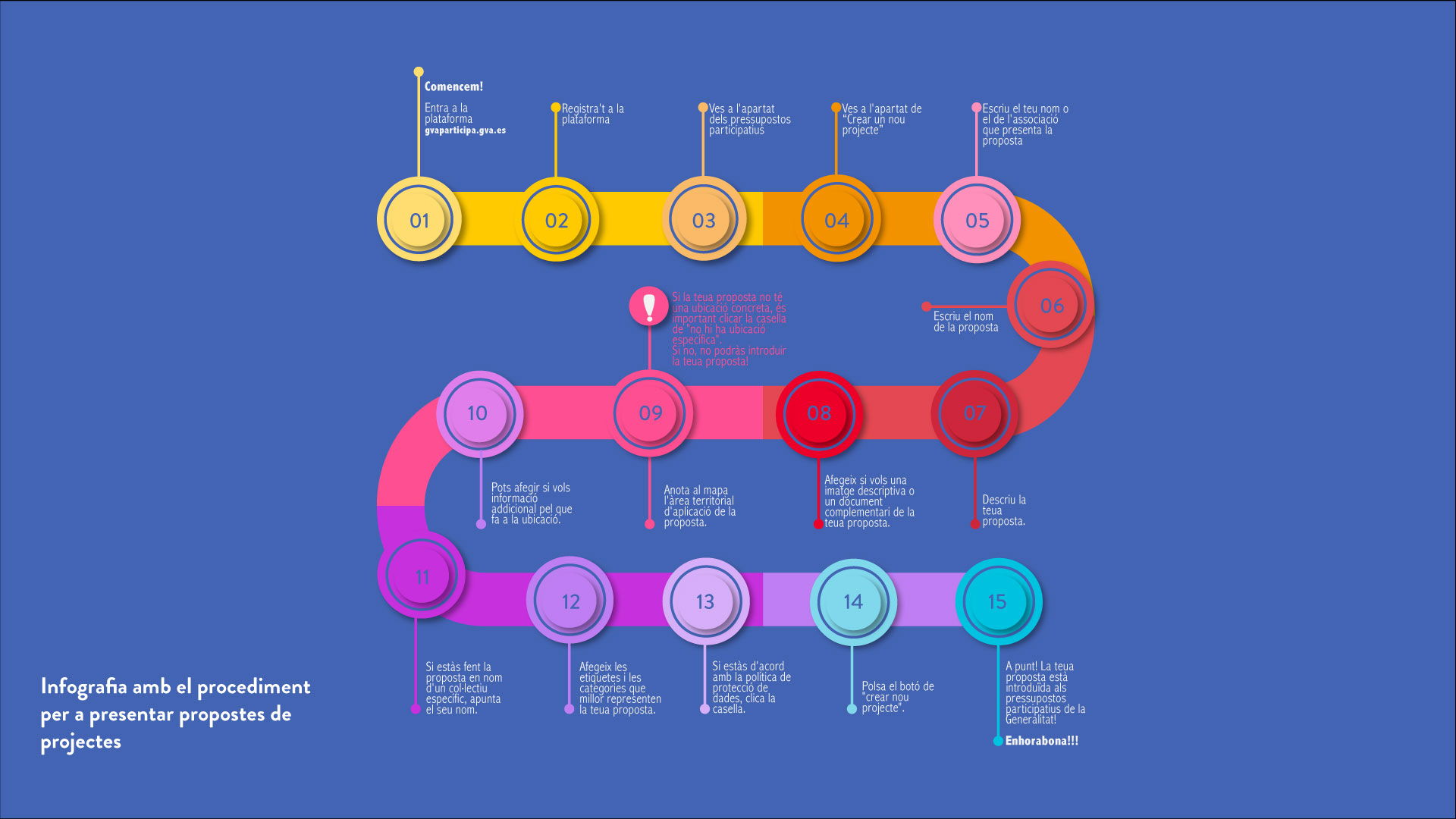
Participatory budgets of the Valencian Community


Participatory budgets of the Valencian Community

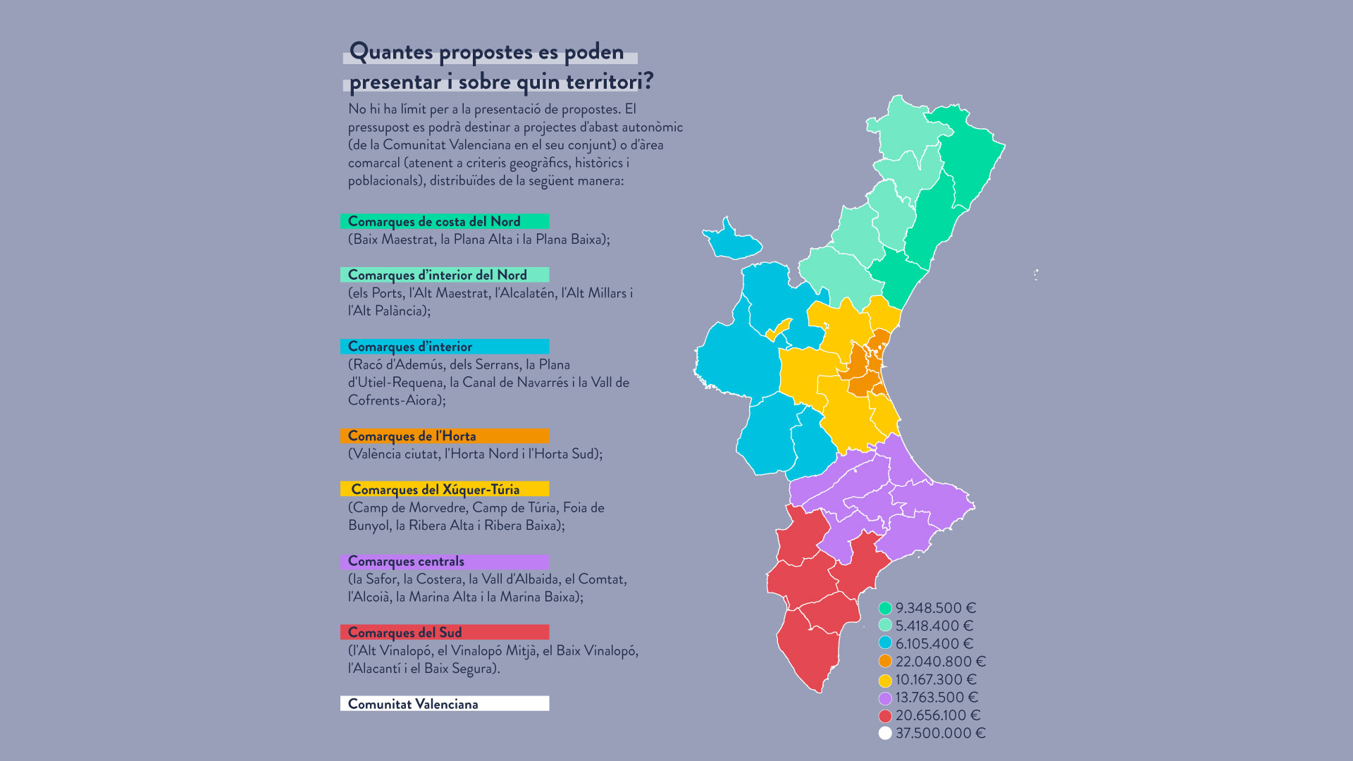
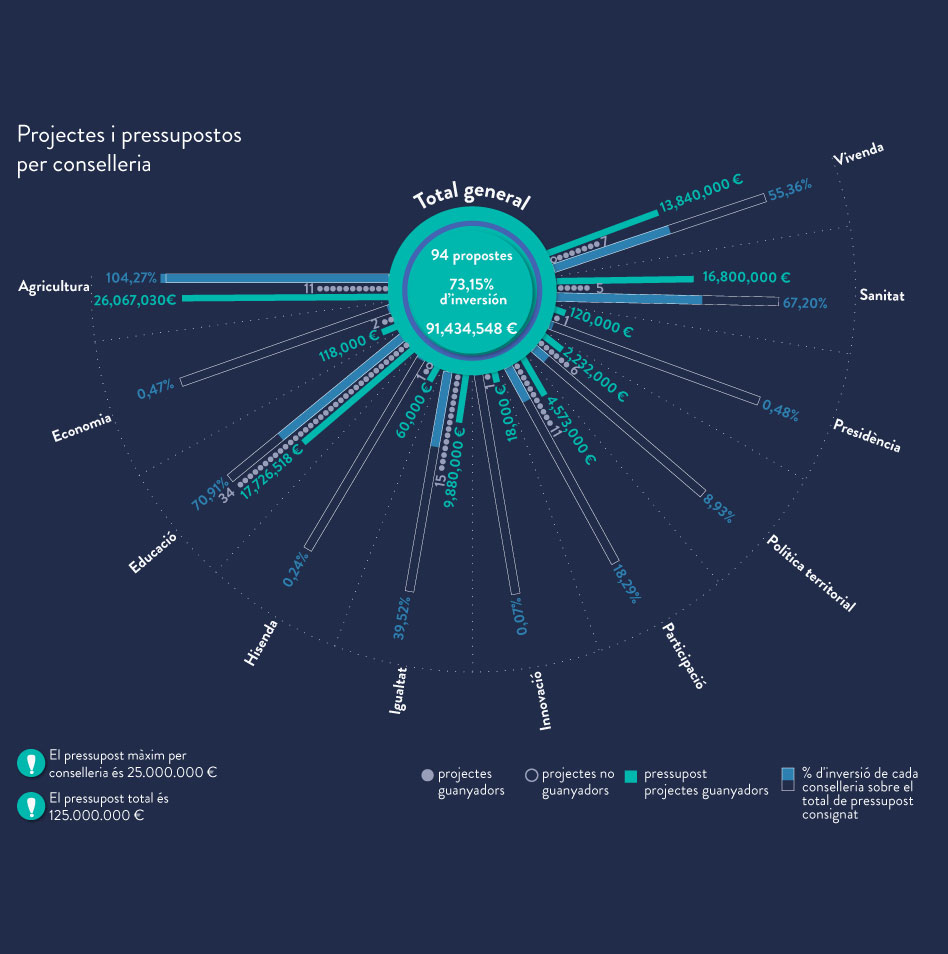
The Autonomous Participatory Budgets are a pilot project of the Generalitat Valenciana that was launched in 2021. It aims to develop a participatory process to decide the actions to which a part of the Generalitat’s budget will be dedicated. It is a powerful tool to move towards an open government that revolves around citizen participation. It opens this process to 5 million Valencian men and women, counting on all the territories and investing in those who need it most.

Participatory Budgets aim to empower citizens and provide public information, transparency, equality, inclusion, gender perspective, territorial solidarity, and accountability. They are also based on the 17 Sustainable Development Goals.

In this project, Monodestudio was the coordinating team, and *estel was the driving team of the Hackatons; These conferences combine information on the process, training on the theme of each action, and the facilitation of a guide space for the design of proposals for the budget, linked to the proposed territorial scale of the counties. Also, we create communicative content to explain the process and the results of the participatory budgets to the citizens.

Place

Valencian Community

[5,057,353 inhabitants]

Scale

Supramunicipal

Type of project

Citizen cooperation

Duration

6 months [2021-2022]

Promoter

Generalitat Valenciana;

Conselleria de Participació,

Transparència, Cooperació i

Qualitat Democràtica


Team

Monodestudio 

*estel (Konstantina Chrysostomou,

Arnau Boix i Pla,  Alba Dominguez

Ferrer, Marc Deu i Ferrer)


Collaborators

Citizens of the Valencian

Community

Entities and associations of

the Valencian Community

Press

Read more about the project

at the plataform gvaparticipa

Action strategy for Villena’s public space


Action strategy for Villena's public space

The Action Strategy for the public space of San Francisco neighborhood is proposed in parallel to the social improvements described in the Community Plan. It has the aim that the actions that are described in it have a comprehensive and holistic nature, understanding and addressing the urban environments as ecosystems, where all the parts that consisted of them are interconnected. 

In this sense, the proposals are organized as a “masterplan”, and they attend to address all these variables, collecting the complexity of an environment like this. Ultimately, the objective is to increase the quality of life of the people who live here, improving the conditions of their physical space, especially in public environments and community spaces, facilitating everyday life and each action linked to the reproductive tasks, often forgotten by traditional urban planning.

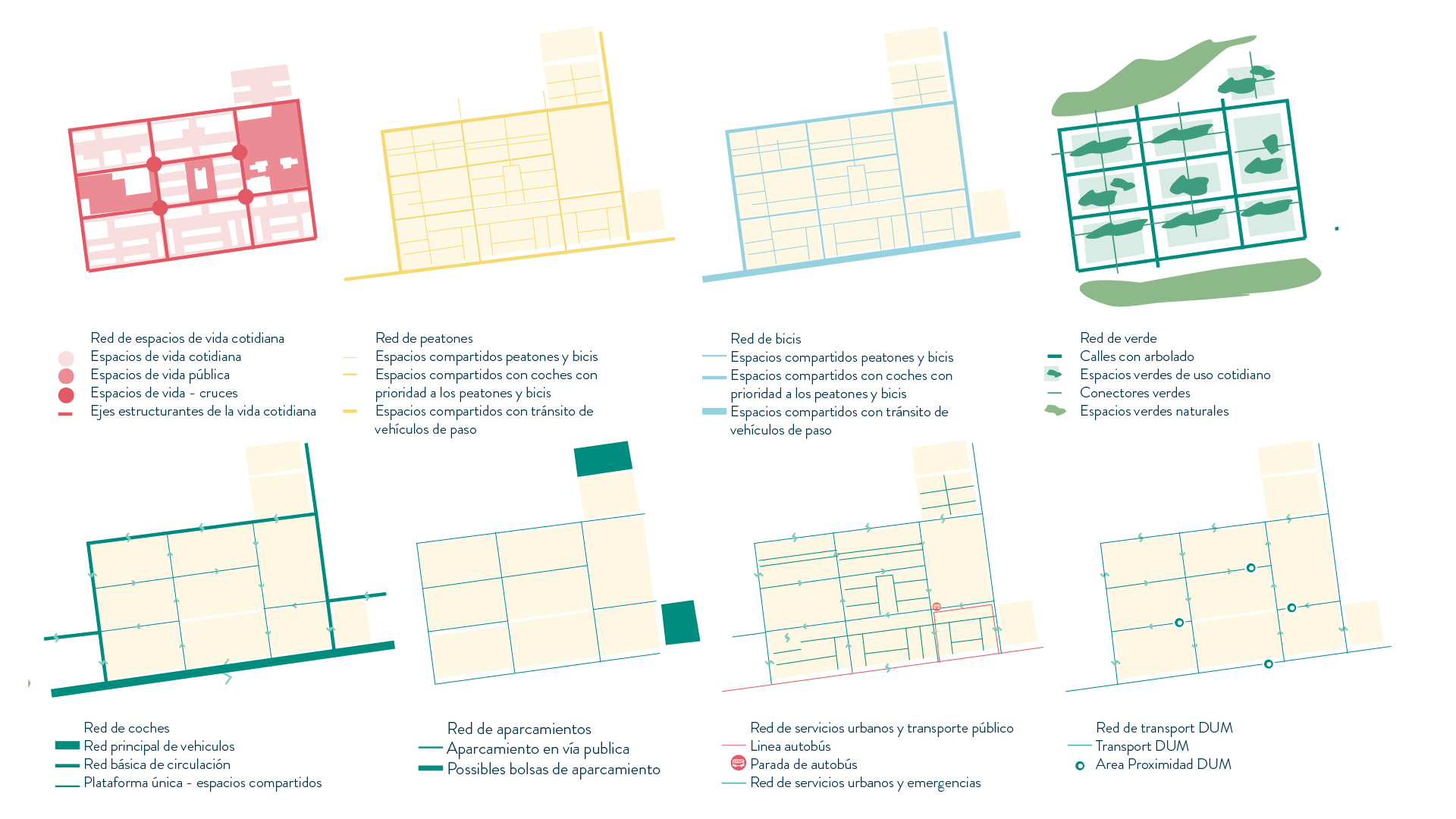
Another of the project’s main objectives is to improve the neighbourhood’s connections, both internal and external, favouring better and more direct relations with the rest of the municipality and the surrounding territory. It is of special relevance to rethink the networks associated with mobility (vehicles, cyclists, pedestrians …), and the rest of the networks and connections, related to green networks, public services.

Action strategy for the public space

The action strategy described below aims to address numerous variables that must be developed in parallel and over time, but without forgetting the overall idea, which guarantees coherence between all of them and allows the ability to generate synergies between them.

By way of summary, we can affirm that the main intention of the project is to deploy a new urban structure, based on concrete actions, that allows to reinforce the everyday life of the neighbours, improving the living conditions of their neihgborhood’s public spaces and streets, as well as of the community buildings that comprise it.

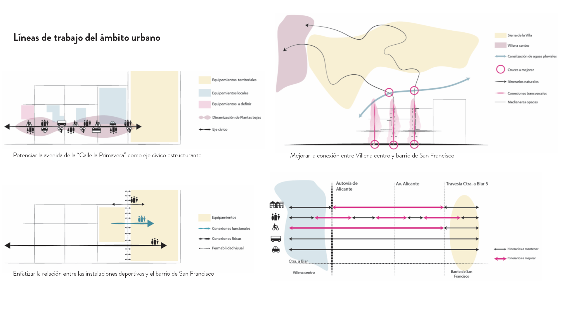
All these wills are specified in these seven points described below:


  1. Pacification of the Old Market Square.

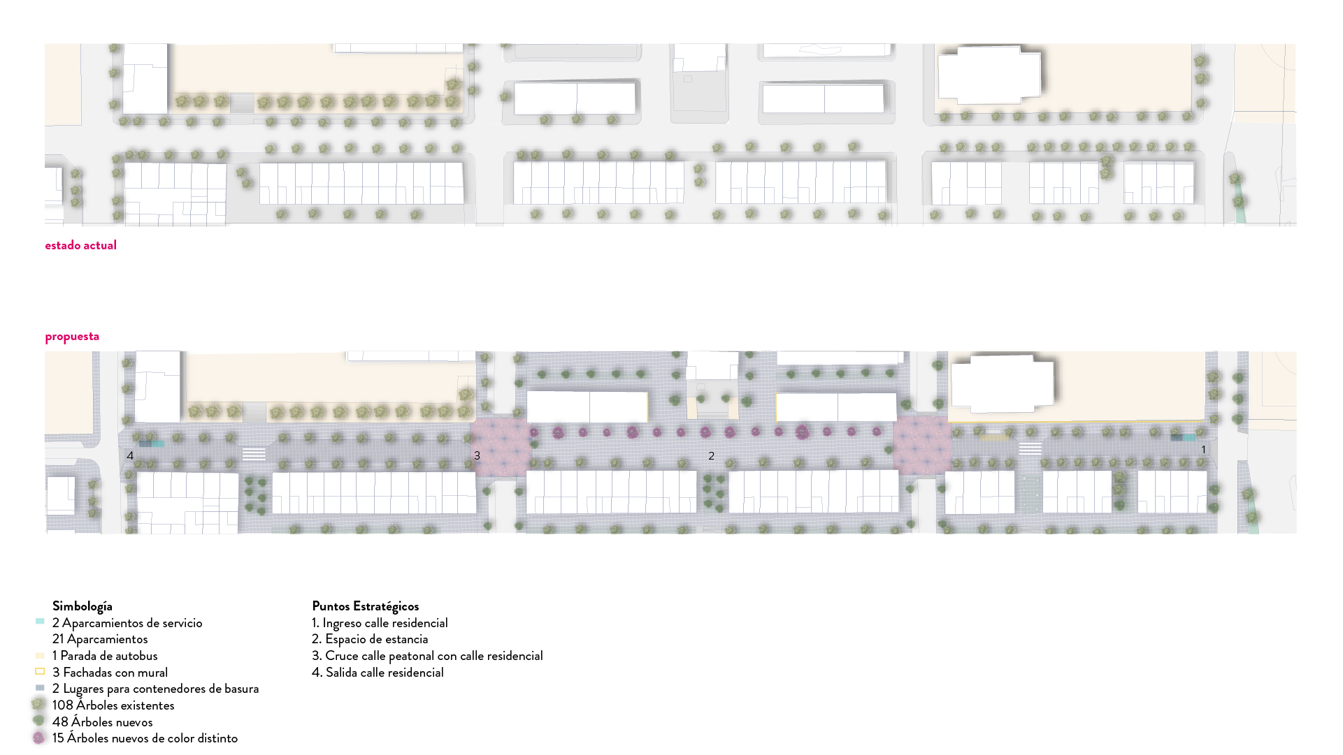
Transform the Market Square into an active and multifunctional space, designed to attract events and diverse uses throughout the year, while improving both living and passing spaces. Its centrality, as well as the diversity of uses of the environment, invites people from different groups to use these spaces. In addition, at the mobility level, it is proposed to prohibit the passage of vehicles at this point, showing that the dominant use is that of people, preventing cars from using this axis to cross the neighbourhood in a longitudinal direction.

  1. Tackle the hierarchy of the road network as “superblocks”.

The San Francisco neighbourhood has the right conditions, so to apply principles similar to those known as “superblocks”. A “superblock” is a larger urban organization unit than a traditional island that provides solutions to the main mobility-related dysfunctions while improving the availability and quality of space for pedestrians. The aim of this strategy is to establish a new hierarchy of the road network, differentiating the passage of vehicles and the pedestrian priority axes.

  1. Definition of Avenue de la Primavera as the main civic axis.

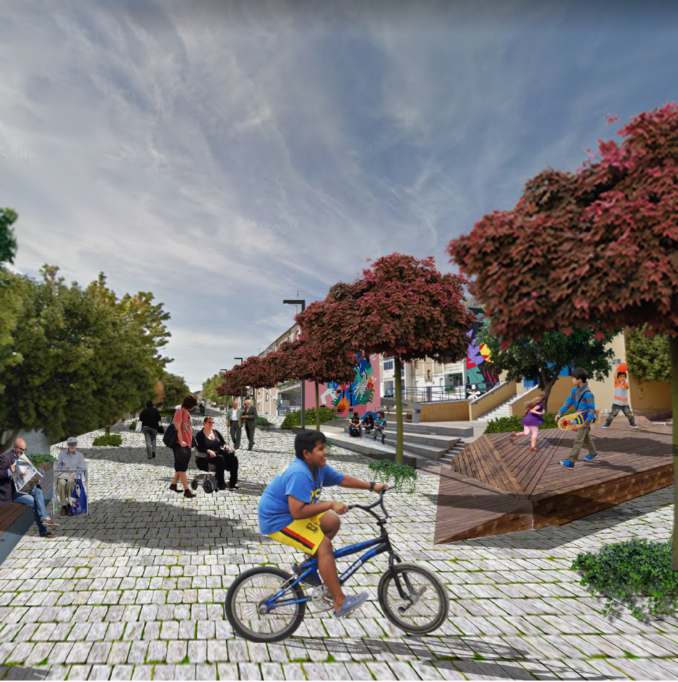
Transform Avenue de la Primavera into the main civic axis of the neighborhood, turning the space of the old Market into a pedestrian area and thus breaking the longitudinality of the axis. In this way, this axis offers a large continuous, and quality surface, which invites you to play informally, ride a bike, and pass time. This street takes on a great relevance in the new identity of the neighborhood, so apart from the architectural proposal, It is proposed to do some kind of artistic intervention on the facades.

  1. Improved connection with the natural environment.

It is proposed to re-connect the neighborhood with its natural environment, by connecting the pedestrian spaces with the main ecological corridors of the mountains. In this way, it is possible to treat the natural landscape as a bigger public space for the people of the neighborhood, structured around the network of natural paths, which, as well as routes, are also meeting points for residents.

  1. Improvement of the continuity of the public space

Connect the interior spaces of the neighborhood with quality pedestrian spaces, with platform streets designed mainly for pedestrians and bicycles, vegetation, play spaces, and activities.

  1. Optimize the connection with the centre of Villena

Update and improve communications with Villena’s center, implementing accessible and comfortable itineraries for bicycles and pedestrians that allow residents to move more comfortably, but also invite people from other neighborhoods to visit San Francisco neighborhood.

  1. Transform the interior spaces of the islands into community “gardens”

It is proposed to convert some interior spaces of the blocks into living spaces, which can act almost as extensions of the houses, with native vegetation, play spaces, and urban furniture that facilitate socialization. It is of main importance that the architectural proposal of each one of these patios recognizes the differences between them, depending on their location, their preexistence, or the neighbours who live nearby. In this way, each community will be allowed to have its own identity, favouring the feeling of belonging to an environment and a community.

Place

Villena, San Fransisco

neighborhood

[33,983  inhabitants]

Scale

Neighborhood

Type of project

Urban Strategies

Duration

5 months [2021]

Promoter

Municipality of Villena


Team

Coordination of the Strategic Plan: 

monoDestudio


Strategies for Actions in public space

and Preliminary Project for Primavera Street:

 *estel (Konstantina Chrysostomou,

Marc Deu i Ferrer, Alba Dominguez

Ferrer, Arnau Boix i Pla)

Executive project for the implementation of a bike lane


Executive project for the implementation of a bike lane

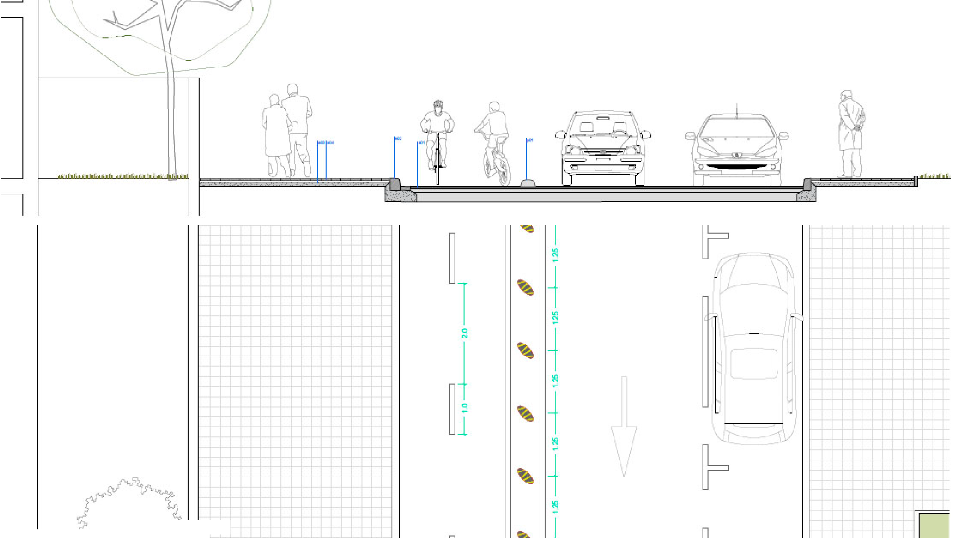
The project begins with the aim of continuing with “Camins Escolars” (School Pathways) that had recently been carried out with the participation of the Riera de Ribes School, amongst others. The proposal therefore includes the will of a very significant part of the local community to improve the conditions of the Avenue “11 de Setembre” and the street “Passeig de la Circumval·lació”. Those two urban axes have a significant importance since they connect the neighborhood with the old town, and various community facilities (Primary and Community Care Center, Sports Centre, School).

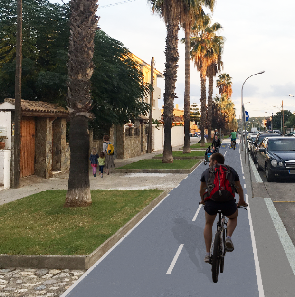
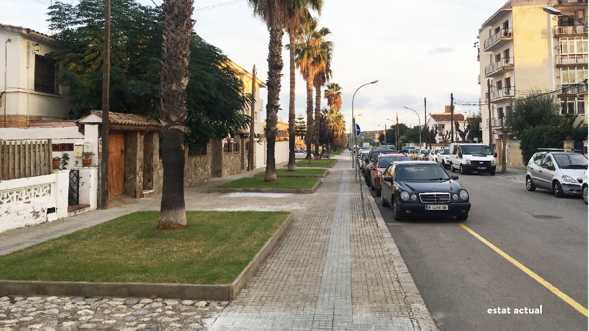
The proposal is based on reversing the current situation where the car is the main protagonist of the space, giving this role to pedestrians and people who ride both bicycles and scooters. The implementation of a bike lane and the improvement of the current sidewalks, both in terms of accessibility and comfort, are the main objectives that have been pursued. In this line, a commitment has been made to implement a variety of vegetation, in order to increase the level of soil permeability and enrich the biodiversity of the neighbourhood, while improving the perceptual experience of the citizens who makes these itineraries every day.

Place

Sant Pere de Ribes 

[30.658 inhabitants]

Scale

Public space

Type of project

Public space design

Duration

10 months [2020]

Promoter

Municipality of Sant Pere

de Ribes


Team

*estel (Marc Deu Ferrer,

Arnau Boix i Pla, Konstantina

Chrysostomou, Alba

Domínguez Ferrer)


Toni Elvira

Gustau Farell

Meeting Space, La Rectoria


Meeting Space, La Rectoria

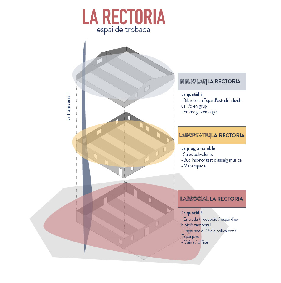
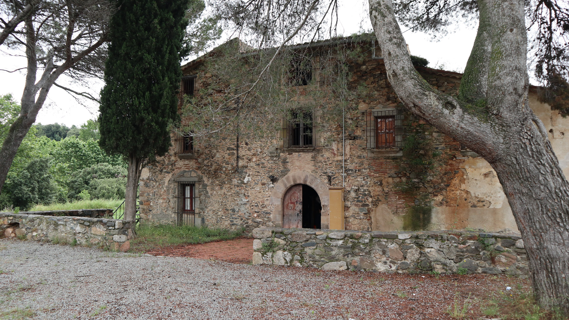
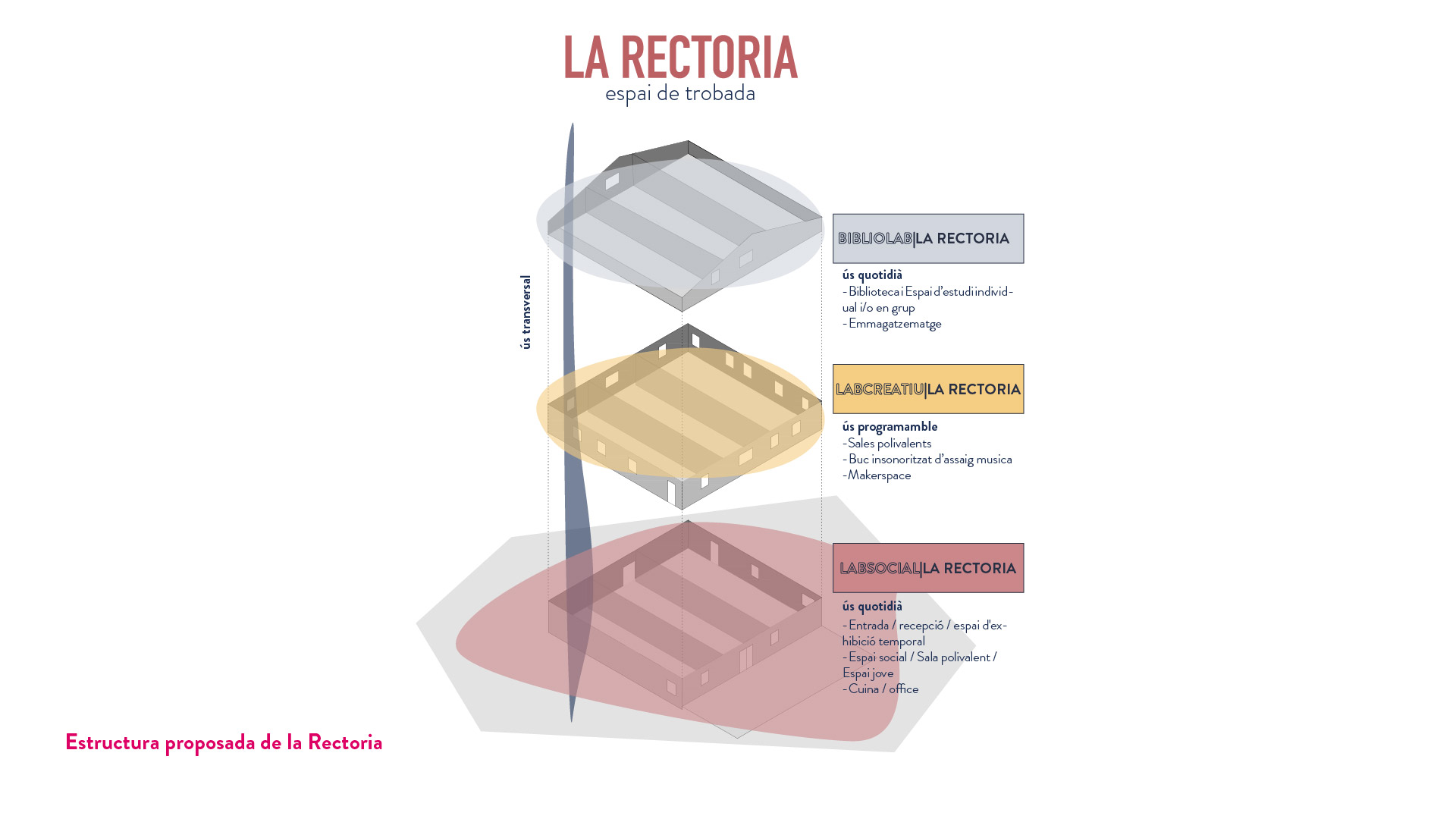
The participatory process has been carried out with the main objective of deciding the transformation of La Rectoria into a reference facility at the municipal level and to propose executive criteria for the definition of uses and management model of the building. These criteria are based, fundamentally, on the conclusions generated from the realization of a participatory process with the inhabitants of Cànoves i Samalús, the youth group, the municipal entities, in close collaboration with the technical and political team of the municipality. This participatory process has been carried out with the support of the Barcelona Provincial Council, especially in its initial phase.

La Rectoria becomes a space that gives rise to activities and services, related to learning, the community and the environment, accessible to all local citizens of Cànoves i Samalús. This is a third space (complementary to the house and the work space) that plays a prominent role in the public life of Cànoves i Samalús. A space of trust and welcome, where people can access knowledge, be part of the community and try new creative activities. A place where inequalities in local society can begin to be addressed by fostering a sense of place and belonging because the place is created according to the needs of users.

This municipal resource is dedicated to creativity, learning and inclusion and is reborn from the strong identity that the building had in the past as a community space. This facility also provides answers to current and future needs with the coexistence of various spaces and activities that promote the diversity of the local population. This strategy guarantees the future of La Rectoria and improves the access of the most disconnected users, attracts new users who may not have visited it before and forms synergies and opportunities that are easier to maintain thanks to the proximity to other spaces of different character. 

In this way, it provides answers to all phases of the creative and production processes of intergenerational knowledge -generating meeting and individual and / or collective work spaces- and resources at the disposal of entities, cultural and social agents and the public. In addition, it offers training resources and visibility of projects and activities that are already taking place in the municipality.

With this process, it is committed to close collaboration between the different groups, entities, associations and the city council. Through co-dynamization, a community-based mutual trust is created as a symbol of “us”, so that they shape and grow the rectory project.

In this case, the project of La Rectoria and its activation proposal aims to build basic values such as trust and respect, which help to create sustainable social development in the municipality. In the case of the young group, giving them responsibilities and voice through this equipment, we promote them so that they become active citizens who participate in society on equal terms with other groups and entities.

Therefore, La Rectoria meeting space is defined based on the following three axes:

  • Places of life and social encounter
  • Respect and commitment to the environment and the territory
  • Exchange of knowledge, skills and ideas

Place

Cànoves i Samalús 

[3,117 inhabitants]

Scale

Municipal

Type of project


Urban Strategies

Citizen cooperation

Duration


6 months [2020]

Promoter


Municipality of Cànoves i

Samalus


Barcelona Provincial Council


Team

*estel (Konstantina

Chrysostomou, Arnau

Boix, Marc Deu, Alba

Dominguez)


Collaborators

Political and technical team of

the city council


Citizens of Cànoves and

Samalús


Municipal entities


JAC (Joves Alcem Cànoves)

Presentation

Check the presentation

at prezi 

Can Canyameres, Community and Culture


Can Canyameres: Community and Culture

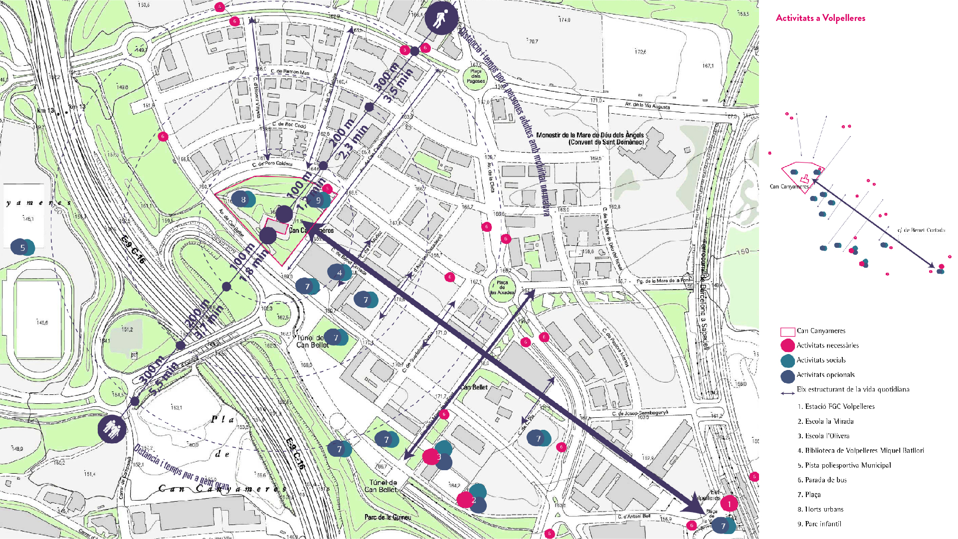
This project has been carried out with the main objective of deciding the transformation of the old farmhouse of Can Canyameres into a reference facility at the neighbourhood and municipal level,   proposing executive criteria which define the uses and the building design. These criteria are based, fundamentally, on the conclusions generated from the realization of a participatory process with the inhabitants of Sant Cugat, in close collaboration with the technical and political team of the municipality.

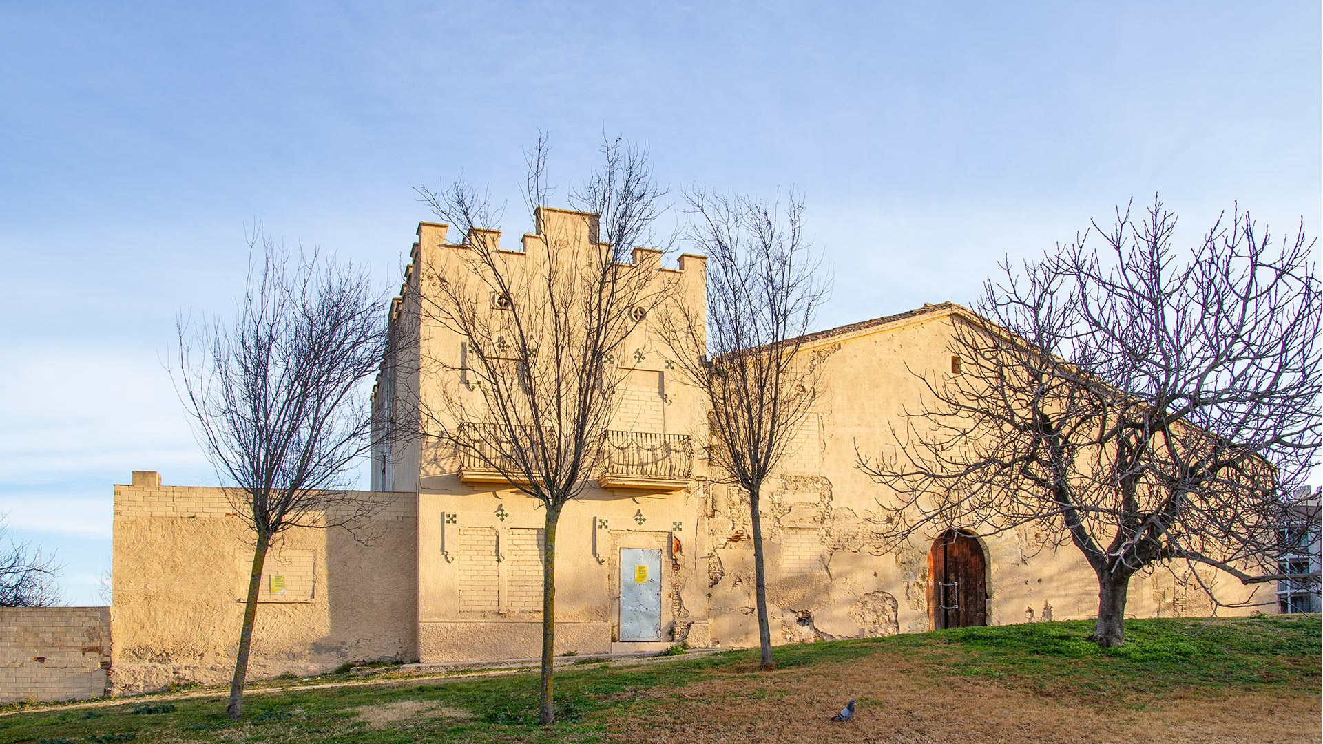
Regarding the complex of Can Canyameres, it is an emblematic space and deeply rooted in the agricultural and architectural history of Sant Cugat, which is transformed into a space dedicated to culture, neighbourhood and cooperation. A community and cultural space.

The proposal treats the complex as a third space (complementary to the house and the work space) that has a prominent role in the public life of Sant Cugat. A space of trust and welcome, a space of social integration where people can access knowledge, be part of the community and try new creative activities. A place where inequalities in local society can begin to be addressed by fostering a sense of place and belonging because the place is created according to the needs of users.

This municipal resource is part of the network of local cultural facilities and is dedicated to the community, culture, learning, environment and inclusion and is committed to being a platform that contributes to the social transformation of Sant Cugat and the neighbourhood of Volpelleres in particular.

With this process, it is committed to close collaboration between the different groups, entities, associations and the city council. The container is managed by the city council, while the content is coordinated by the public. This coordination of the complex turns into a symbol of “us”,  creating a mutual trust between the community and the administration, making Can Canyameres project grow.

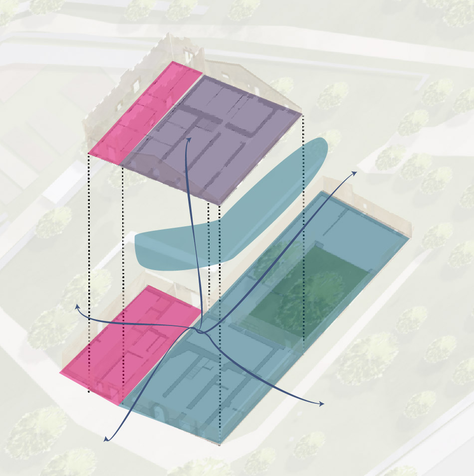
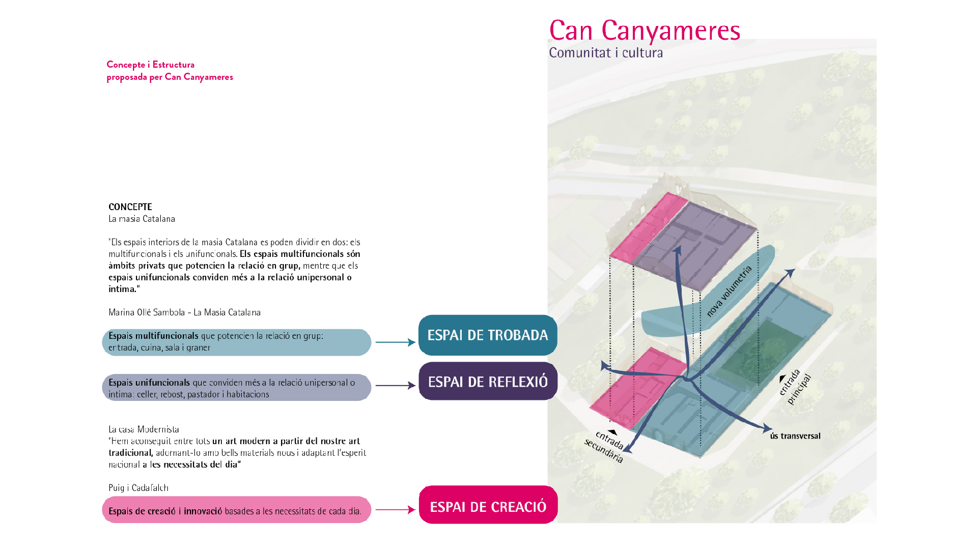
In this case, the Can Canyameres project and its activation proposal, aims to build basic values such as trust and respect, which help to create sustainable social development in the municipality. Thus, the project is inspired and organized with the concept of the Catalan farmhouse and the philosophy of Modernism. From this, the Can Canyameres complex is organized into three spaces that are interconnected and complementary: 

Creation space (The modernist house)
It is the space where workshops, courses or activities related to art and cultural innovation take place.

Meeting space (Ground Floor of the Farmhouse)
It is the space where “neighbourhood is made” with places of socialization and interaction, and it is where the creations of the community are made visible, where the exchange of knowledge and collective learning takes place.

Reflection space (First Floor of the Farmhouse)
It is the space where content and container management takes place, and it is where the courses and trainings take place. It is in this space that community innovation takes shape.

Place

Sant Cugat

[90,664  inhabitants]

Scale

Municipal

Tipus de projecte

Urban Strategies


Citizen cooperation

Duration

5 months [2021]

Promoter

Municipality of Sant Cugat

del Vallès


Team

*estel (Konstantina

Chrysostomou, Arnau

Boix, Marc Deu, Alba

Dominguez)


Collaborators

Neighbors of Sant Cugat

del Vallès

Entities and associations

Technical and political team

of the city council

Presentation

Check the presentation

at prezi 


Video

Watch the video of the

process on youtube


Press

Read more about the project

at decidim

Inventory of constructions on undeveloped land


Inventory of constructions on undeveloped land

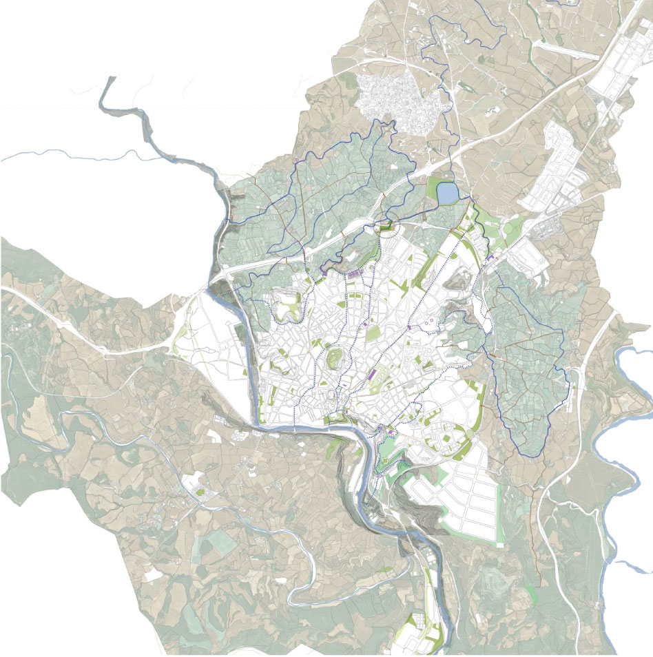
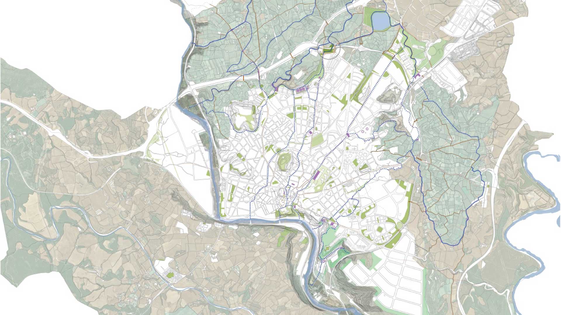
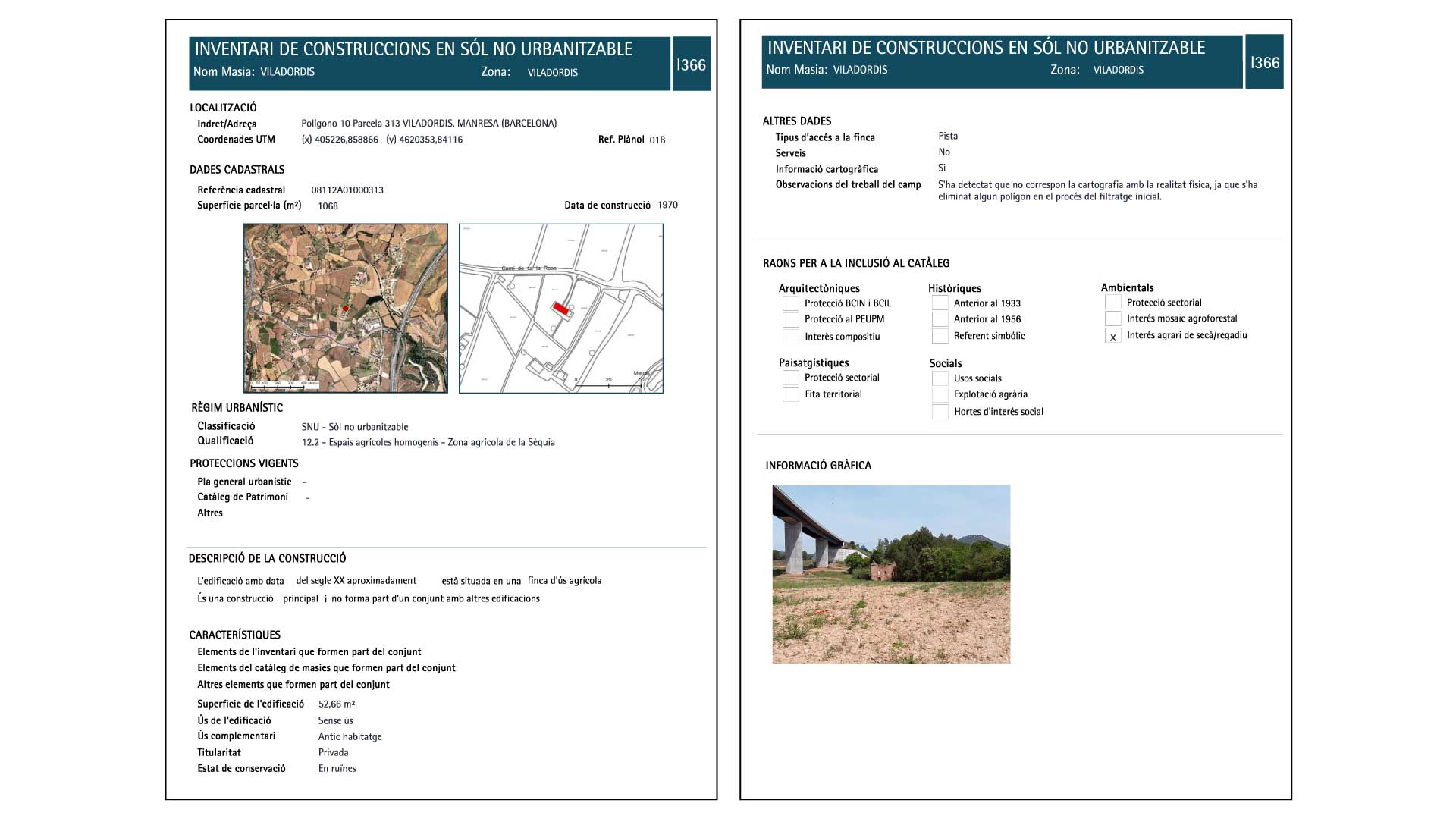
The regulation of the undeveloped land is one of the challenges that municipalities will face in the coming years, as a balance must be found between the uses and activities that are allowed and the preservation of the natural habitats and ecosystems of each territory.

In this context, the city of Manresa has promoted the creation of an inventory of buildings in undeveloped land in order to know the current reality of the municipality before deciding how to transform it, in parallel to the catalog of Masias already definitively approved.

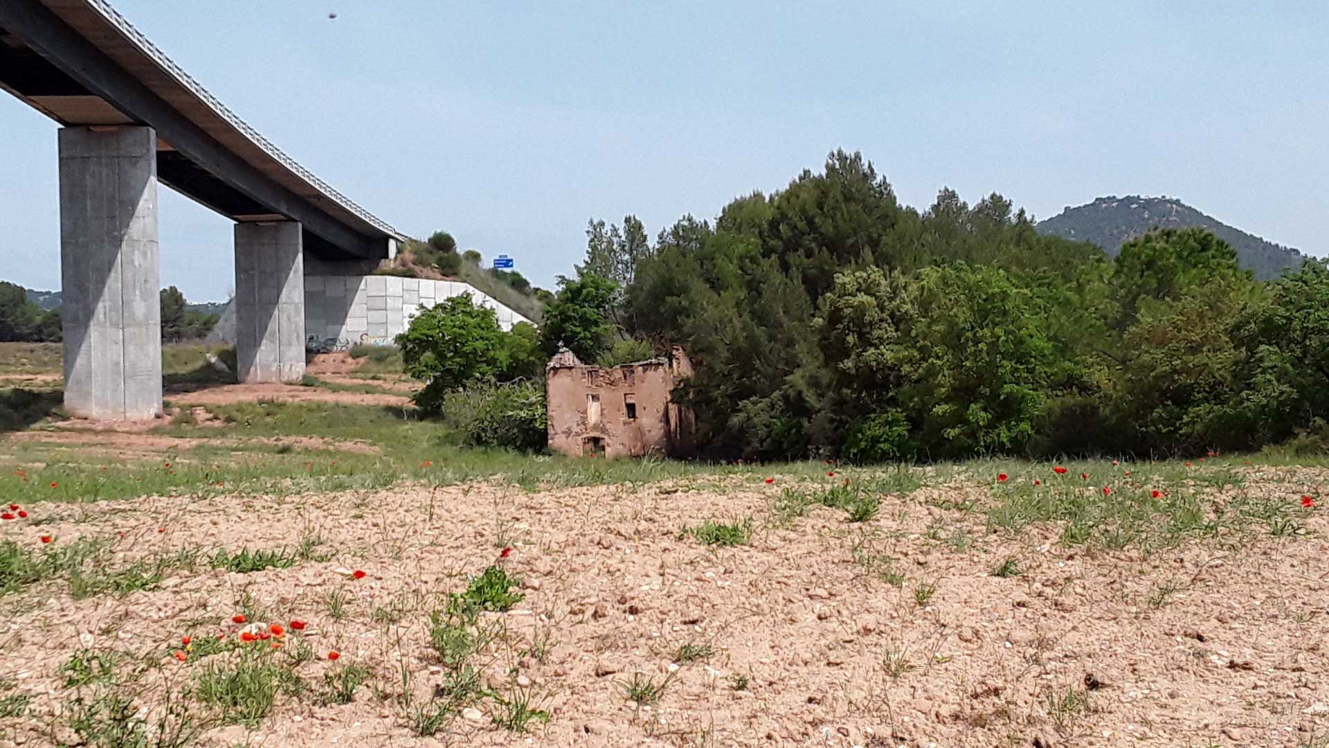
Our approach to the project as *estel was to understand the architectural, urban, and environmental characteristics of each element included in the study, but without forgetting the social and human components that these constructions have. In an environment such as Manresa, they play a key role in structuring and articulating the territory, and in defining the character and identity of the people who inhabit it.

The collaboration with Solucions Geogràfiques team has allowed us to integrate GIS technology in a transversal way throughout the work, and facilitate the management and updating of information in the future.

Place

Manresa

[76,250 inhabitants]

Scale

Municipal

Type of project

Urban Strategies

Duration

11 months [2019]

Promoter

Municipality of Manresa


Team

*estel (Marc Deu, Alba

Dominguez, Arnau Boix,

Konstantina Chrysostomou)

Solucions Geogràfiques

Can Quel, Creation Factory


Can Quel, Creation Factory

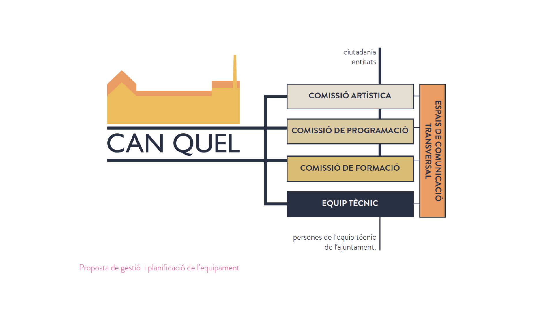
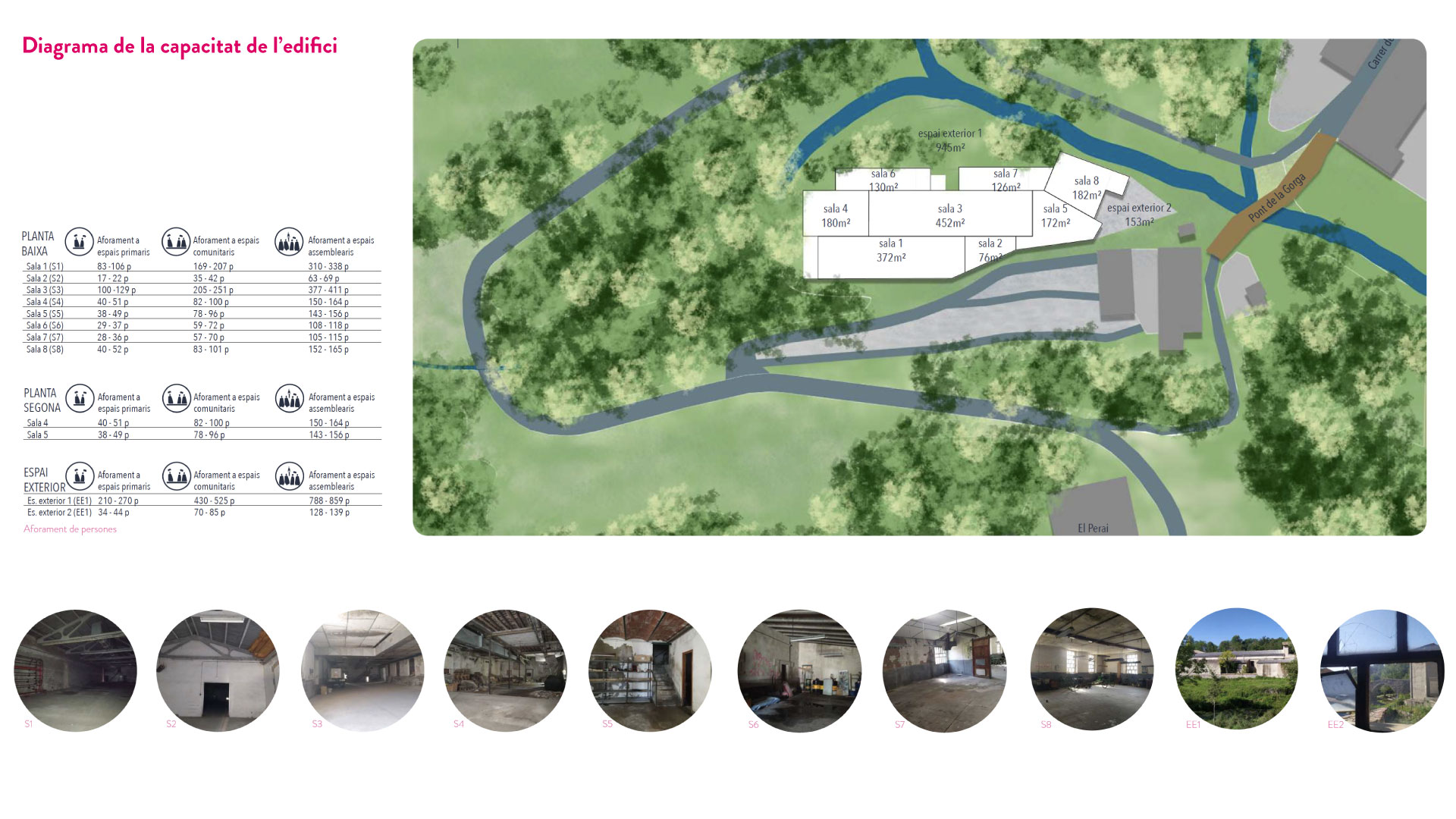
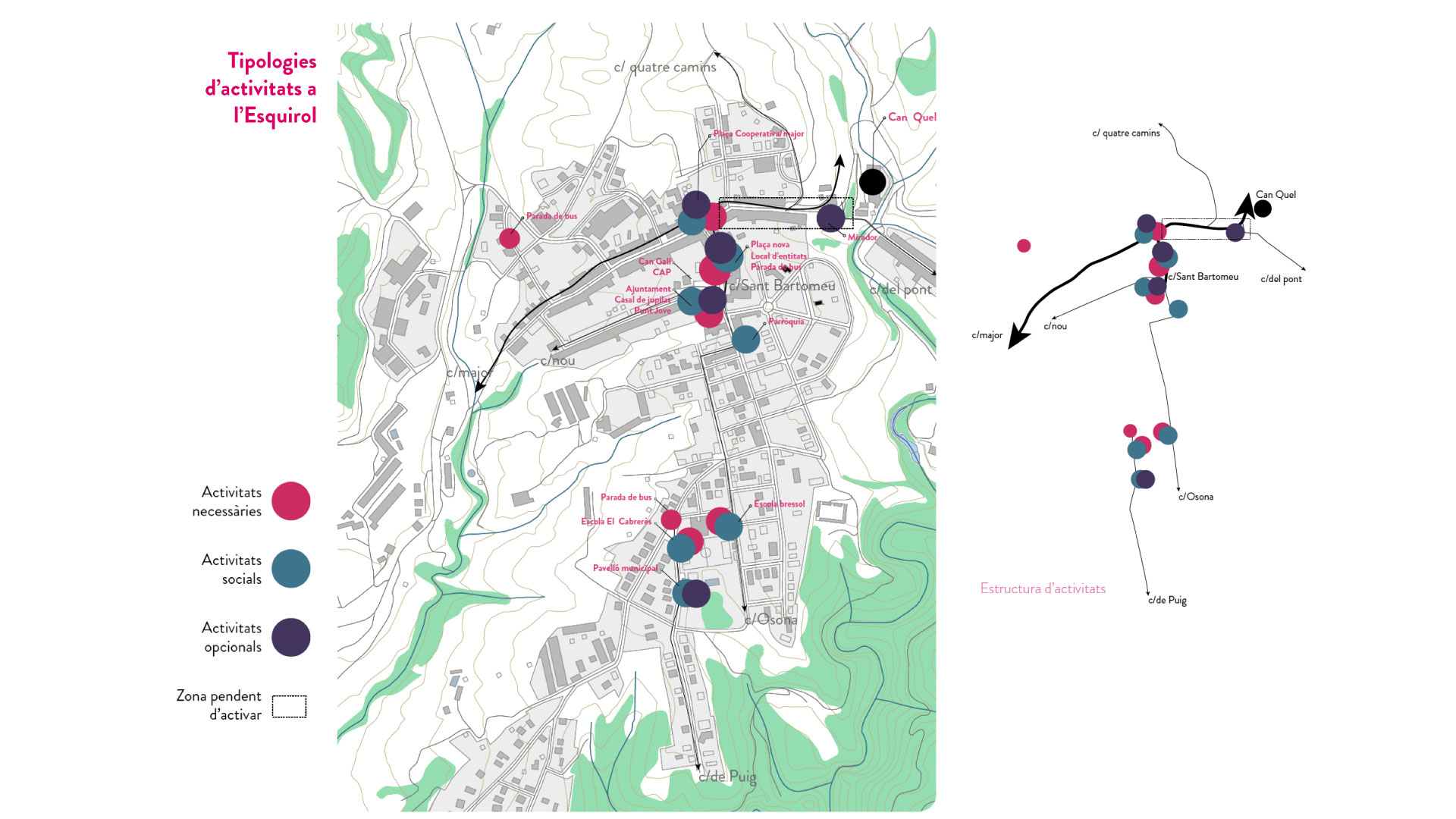
The old Can Quel textile factory, an emblematic building deeply rooted in the history of l’Esquirol, is transformed into a public center for socio-cultural creation. A factory of creation.

This municipal building recovers the idea of culture, intervention, and the link with the territory, and is committed to being a platform that contributes to social transformation and sustainable development in Collsacabra, and l’Esquirol in particular.

The Can Quel creation factory, re-exists based on the motto “our future is quality” that is still in the factory, but now is related to culture and community. Likewise, it provides answers to every phase of creative processes and knowledge production -generating individual and/or collective workspaces and making resources available to artists, entities, cultural and social agents, and the public. In addition, it offers educational resources and visibility of projects and activities that reinforce the municipality of Esquirol as a cultural and social pole in Collsacabra.

It is committed to direct collaboration with the different groups to co-manage the equipment, in order to be the ones who shape and make the project grow. 

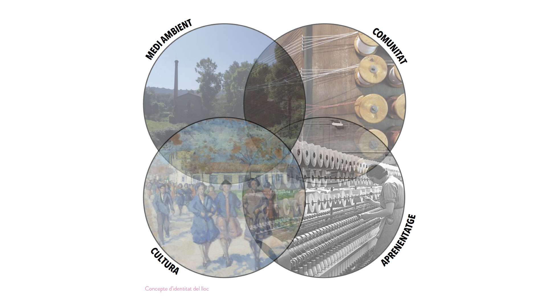
Can Quel creation factory would be defined from the following three axes:

  • Cross-border culture and education
  • Places of life and social gathering
  • Respect and commitment to the environment and the territory

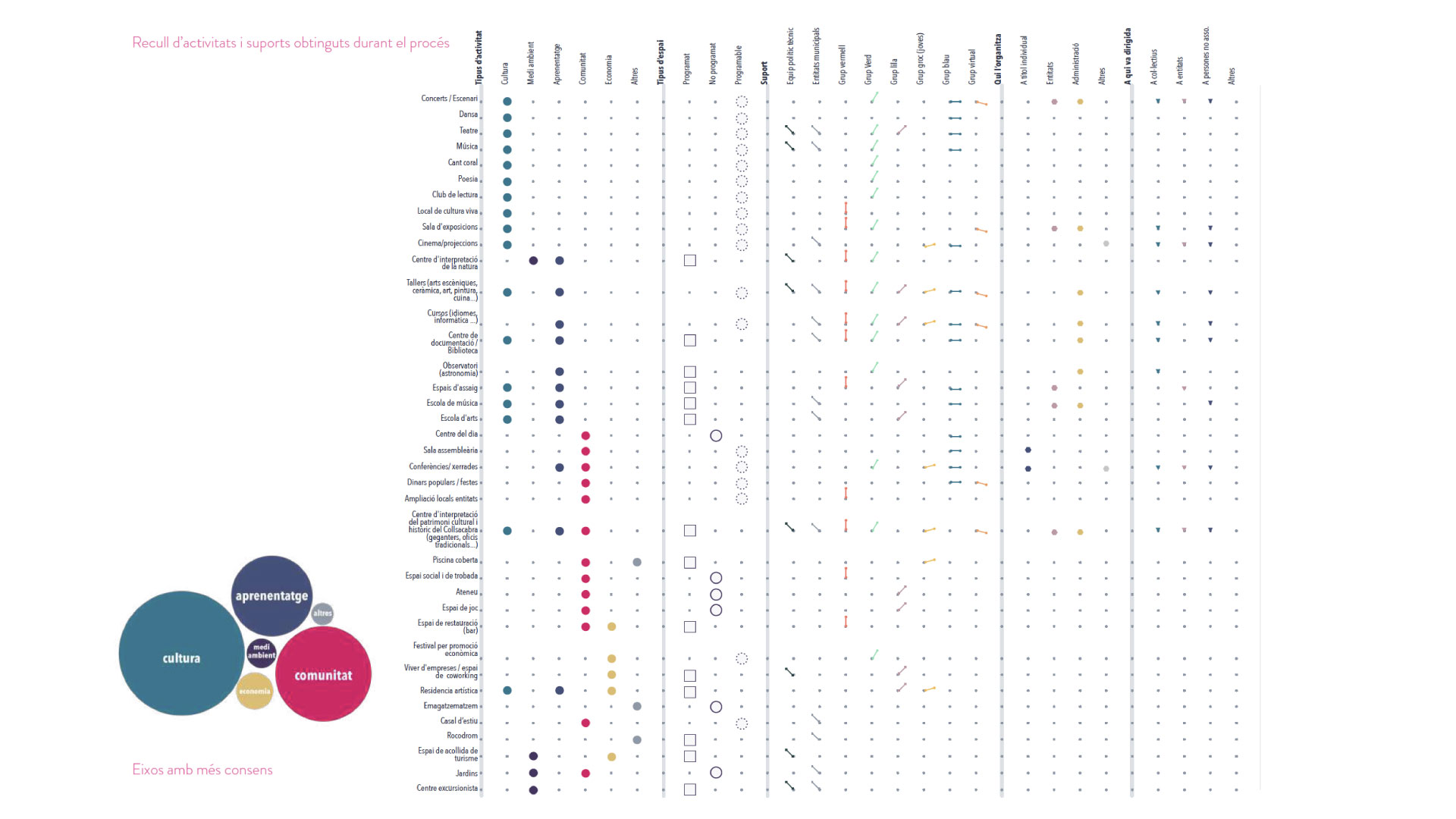
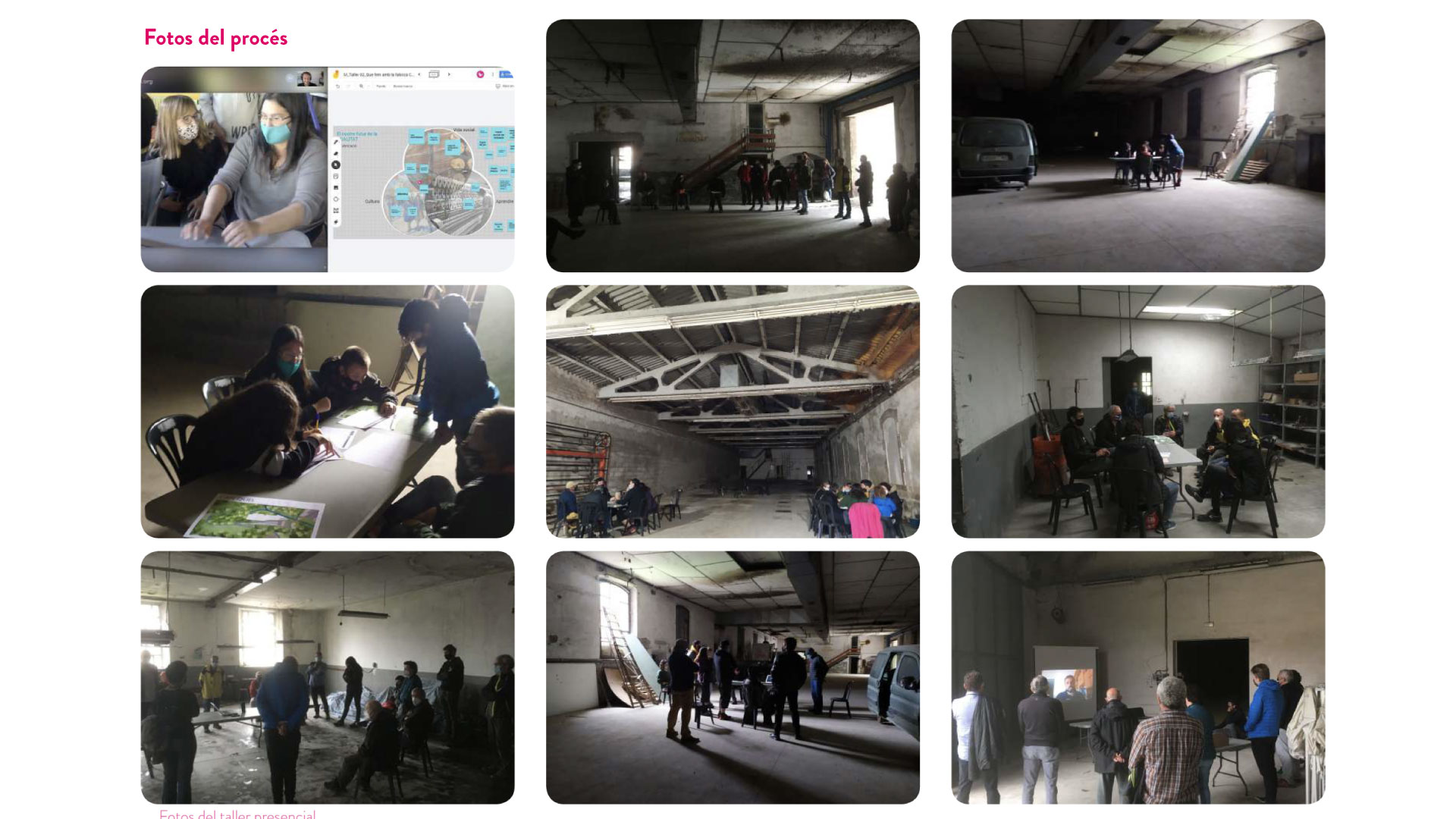
The participatory process was designed following the PRA methodology (Participatory Research-Action) with the aim of incorporating the maximum diversity of intergenerational perspectives and promoting an inclusive space at l’Esquirol. During the participatory process, the Functional Program, the architectural and urban intervention criteria, the management model, the execution phases, and the management of the “meanwhile” were worked with the local community.
Place

L’Esquirol

[2,181 inhabitants]

Scale

Municipal

Type of project

Urban Strategies

Citizen cooperation

Duration

3 months [2020]

Promoter

Municipality of l’Esquirol

Barcelona Provincial Council


Team

*estel (Konstantina

Chrysostomou, Arnau

Boix, Marc Deu, Alba

Dominguez)


Collaborators

Neighbors of l’Esquirol

Municipal entities

Youth Centre

Technical and political team

of City’s Council

Presentation

Check the presentation at prezi

Socio-territorial analysis in the Study of the Urban Landscape of Montbau


Urban Landscape Study of Montbau

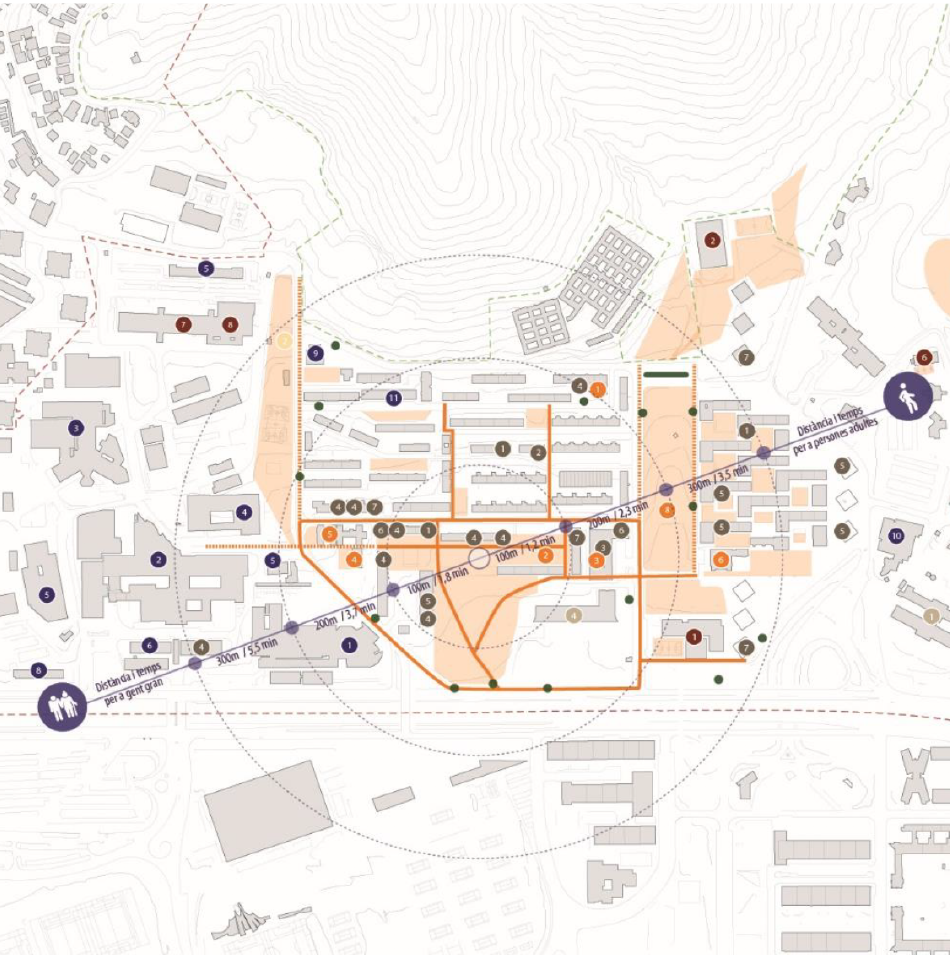
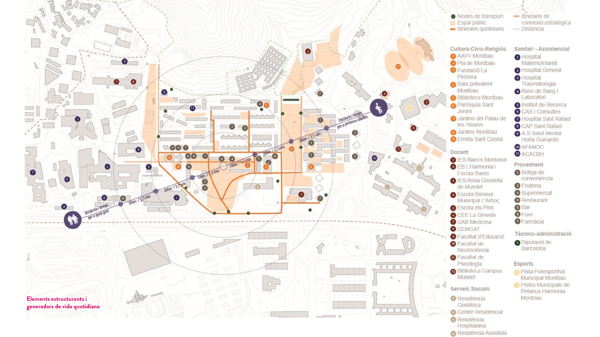
An Urban Landscape study, and especially in a complex area such as Montbau, inevitably approaches the work from various intertwined perspectives in order to reflect the urban reality.

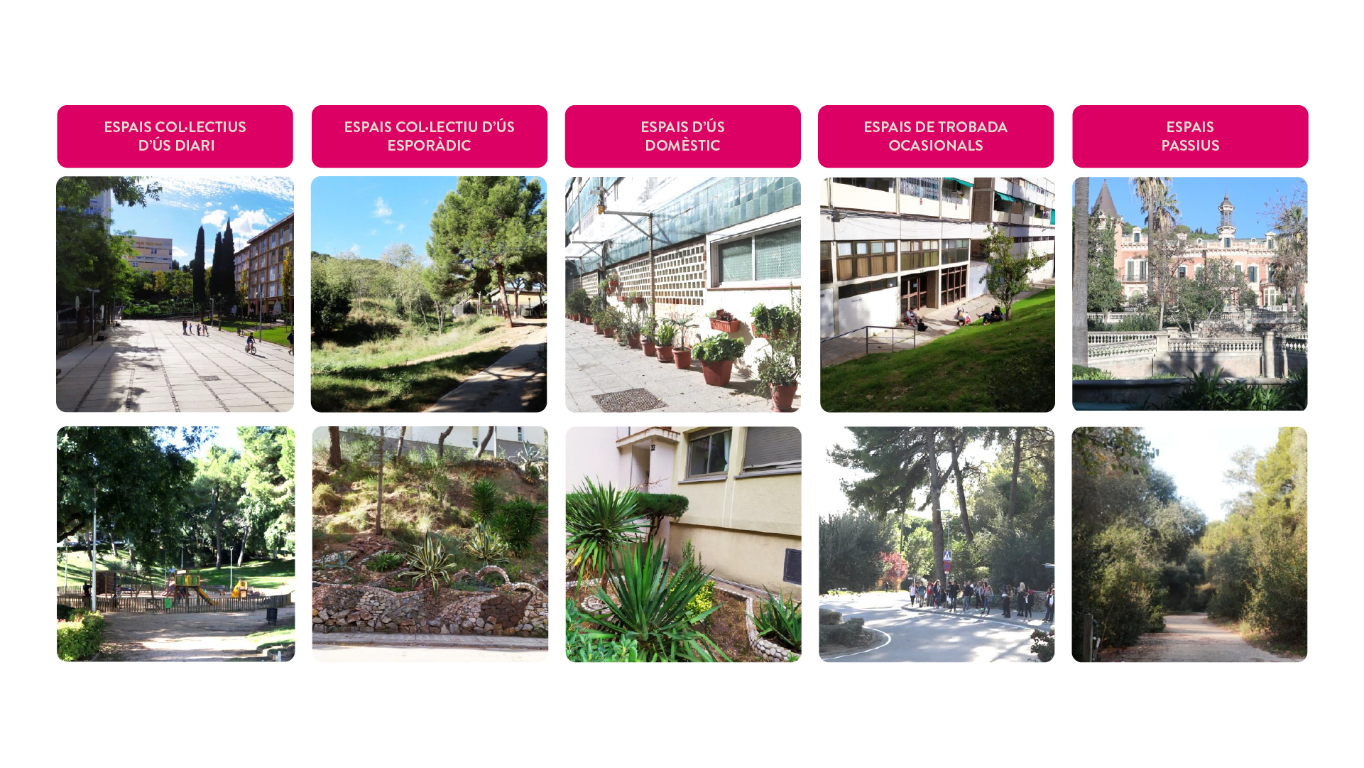
In this case, *estel formed part of a very large team of professionals, and focused on the socio-territorial study, analyzing the human landscape and the everyday dynamics of the neighbourhood, as such as to understand how people relate to the territory as well as to each other.

Through a series of debates with representing stakeholders of the neighborhood in addition to the public realm observation, it was possible to relate amongst others; what was the perception of security in various areas of the neighborhood, which formal and informal spaces were best valued, and why, what urban characteristics define the identity of the neighborhood or in which way the relationship between the city of Barcelona and the mountain of Collserola is perceived.

Place

Barcelona

[1.636.762 habitants]

Scale

Neighborhood

Type of project

Urban Strategies

Citizen cooperation

Duration

8 months [2019]

Promoter

Institut Municipal del

Paisatge Urbà i la Qualitat

de Vida


Team

B2B Arquitectes

*estel (Marc Deu,

Konstantina Chrysostomou,

Arnau Boix, Alba Domínguez)

Irbis

Veclus S.L.

Jordi Bellmunt

Agata Buscemi

Fàtima López

Montserrat Mercadé


Collaborators

Neighbors of Montbau

Informe

Read the full report at

BCNROC Barcelona

Transforming Ca n’Altimira into a space for community innovation


Transforming Ca n’Altimira into a space for community innovation

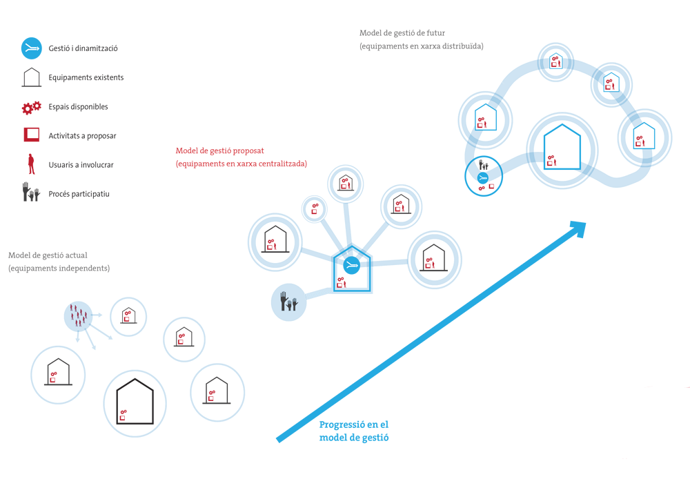
How can we define new uses for a symbolic building respecting its history and its importance for citizens? How can we transform it into a pedagogical space where the social fabric is empowered, allowing us to speak for a new model of co-management of the municipal facilities?

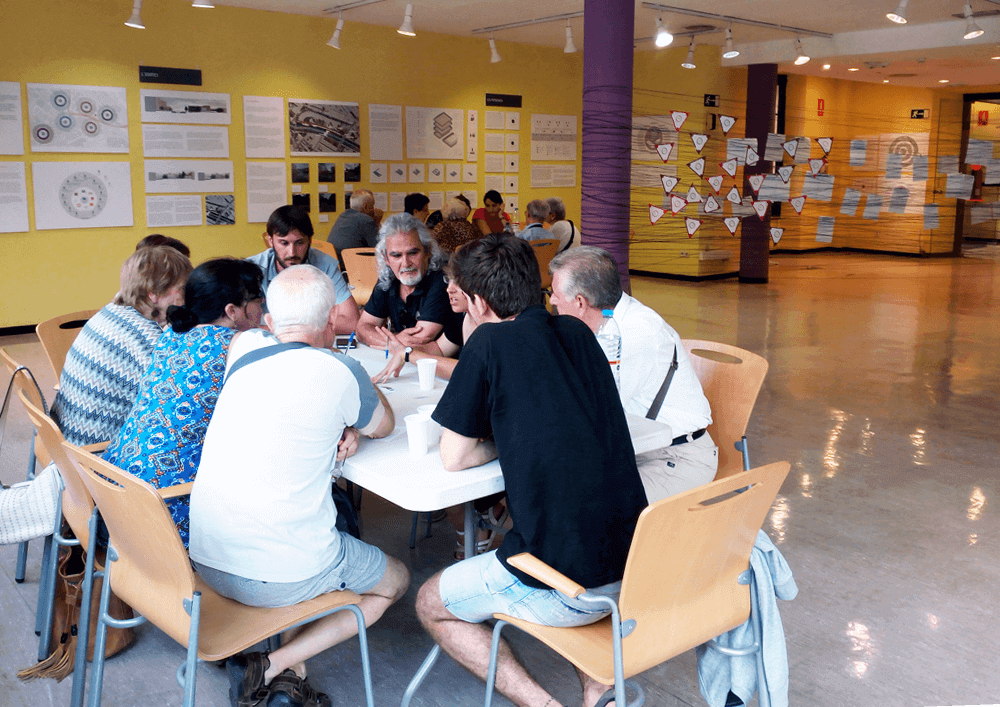
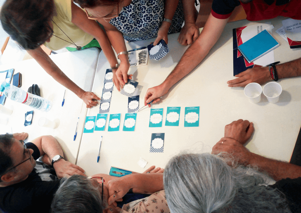
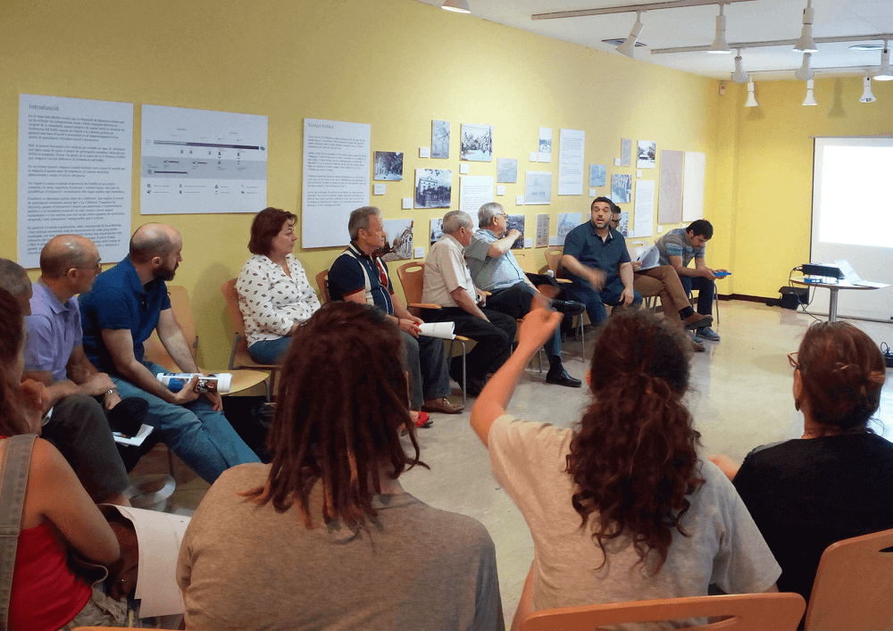
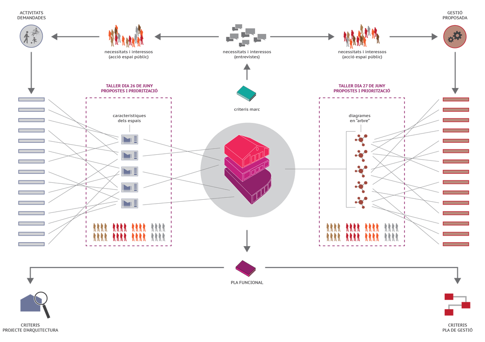
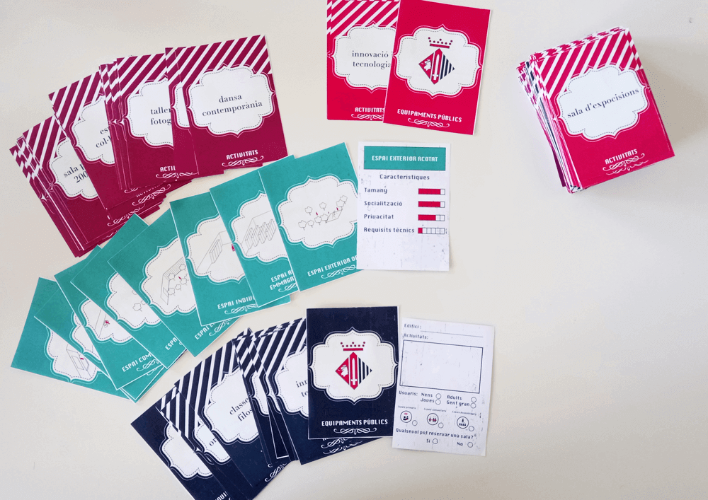
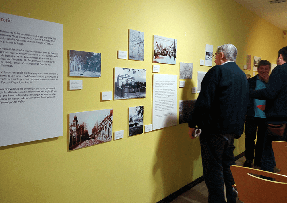
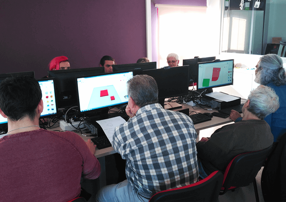
The process of citizen participation for the definition of the new uses and the management model of the old municipal library of Cerdanyola del Vallès was an innovative and intergenerational project. During the process, were carried out, on the one hand, participatory actions (talks, table games, walks, 3d printing, …) and on the other the communication plan of the process (informative actions on public space, communicative image, exhibition, and installations regarding Ca n’Altimira’s history, and its participative process). 

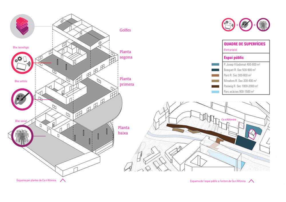
The involvement of citizens during the collaborative analysis and diagnosis helped to detect the needs regarding spaces and activities and to structure a network of municipal facilities that could host them. Moreover, this co-production between administration and citizens helped to build a common story regarding the Functional Plan of  Ca n’Altimira. This Plan includes a program of uses (artistic, technological, social), the equipment’s management model, and the architectural criteria for the transformation and the proposed distribution of uses.

Place

Cerdanyola del Vallès

[57,740 inhabitants]

Scale

Public space

Type of project

Urban Strategies

Citizen cooperation

Duration

13 months [2016-2017]

Promoter

Barcelona Provincial Council

Municipality of Cerdanyola de

Vallès


Team

*estel (Arnau Boix,

Konstantina Chrysostomou,

Marc Deu, Soledad Viteri)

MonoD estudio

Urbanins


Collaborators

Non-associated citizens,

Collectives,

Entities and Associations

Presentation

Check the presentation at prezi


Study

Read the full report at issuu


Press

Read more about the project

in the digital newspaper

 Cerdanyola al dia

Urban strategies for San Francisco neighborhood​


Urban strategies for San Francisco neighborhood

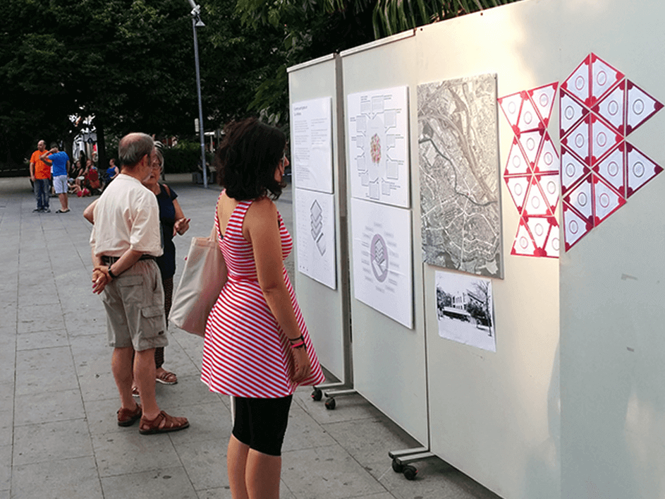
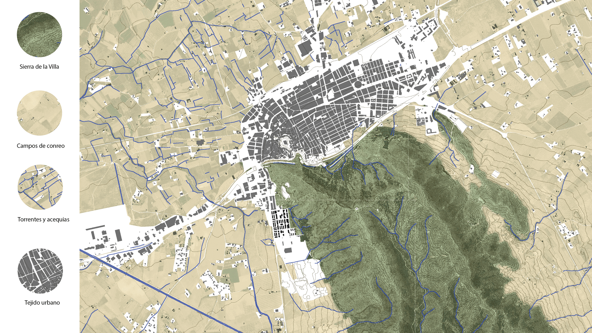
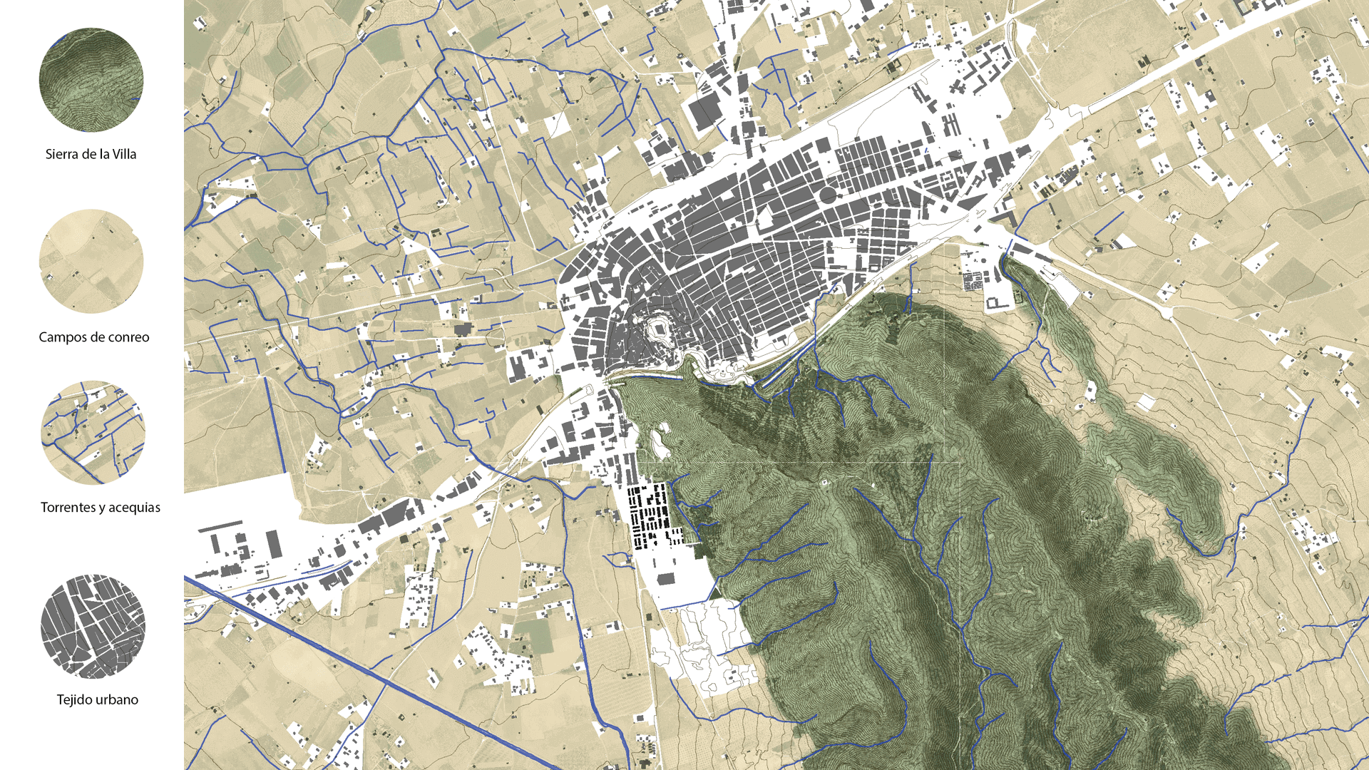
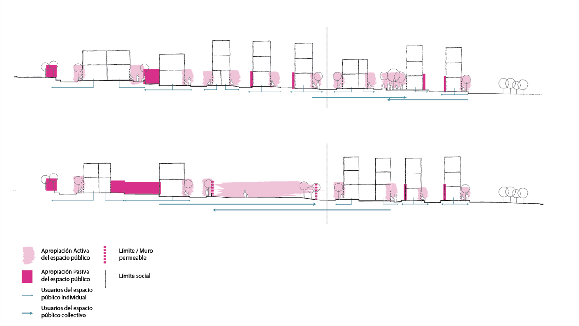
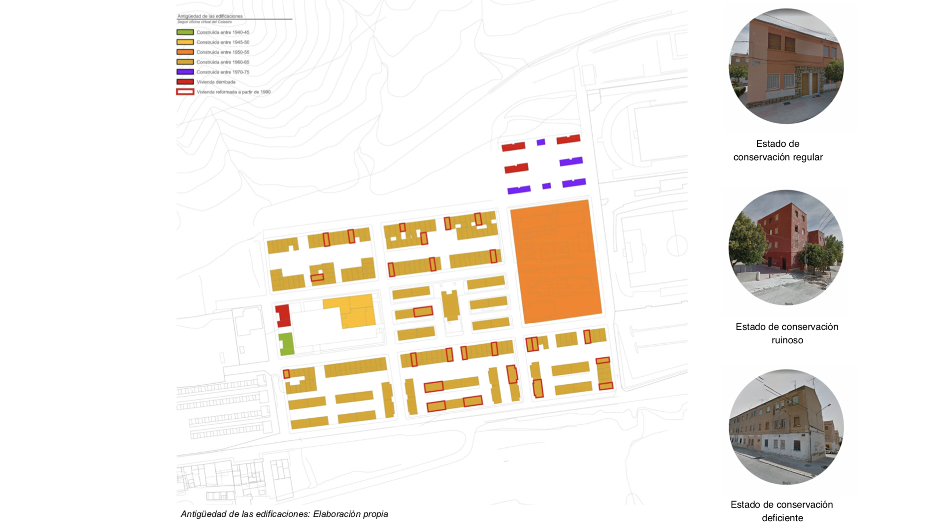
The neighborhood of San Francisco, in the municipality of Villena, is a residential area developed during the 60s by the Francoist Ministry of Housing. Over the years, it has been subjected to a process of constant degradation that has ended to generate a setting with significant deficits both socially and architecturally, subjecting the local population to high levels of social vulnerability.

*estel elaborated a document of urban strategies, which is presented together with the socio-urban diagnostic document prepared by monoDestudio team. Both documents aim to establish the main axes of an intervention that allow reversing these dynamics.

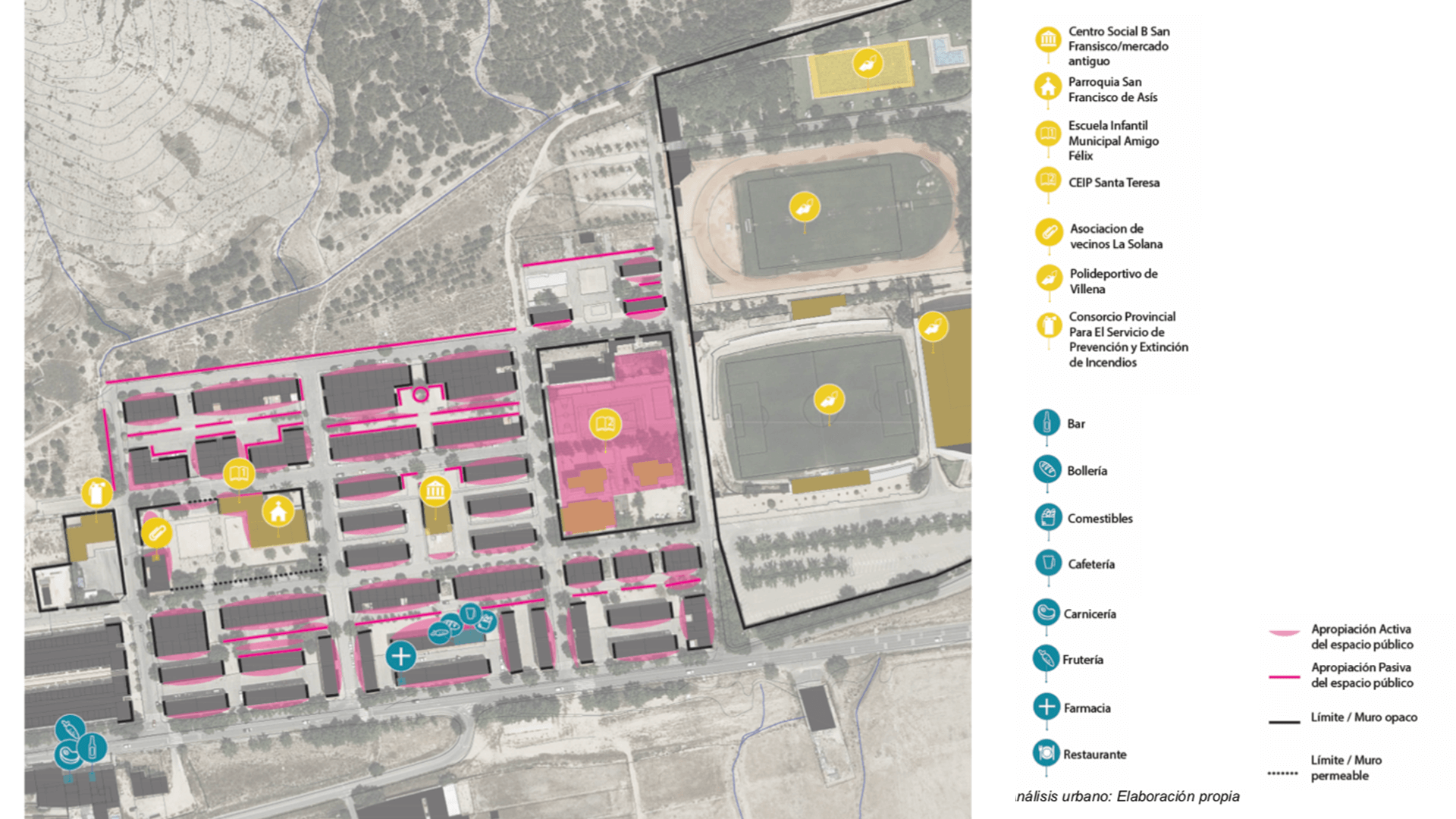
A wide variety of parameters are analysed, ranging from the urban classification defined in the current PGOU (town plan), the conditions of the buildings, the property regime, to the main characteristics that define the neighbourhood’s everyday life.

Various areas of action are defined as taking advantage of the potentials and opportunities detected in the neighborhood,  These transformation actions act as change generators and help to improve residents life quality.
Place

Villena

[33,983 inhabitants]

Scale

Neighborhood

Type of project

Urban Strategies

Duration

6 months [2018 – 2019]

Promoter

Municipality of Villena


Team

monodDestudio


*estel (Arnau Boix i Pla,

Alba Domínguez Ferrer,

Marc Deu Ferrer,

Konstantina Chrysostomou)


TESEU


Collaborators

Neighbors of Villena